Place Names / Local History · Gothic
Erste Erwähnung als Ober Meilnen
- Listed monument


© GeoBasis-DE / LVermGeoRP, dl-de/by-2-0
There is no picture of this object yet. Do you have a photo that you would like to make available to the Kulturdatenbank? Submit a picture
Description
This description is only available in German.
Translate with Google opens this page in Google Translate (external service)
[...] Obermehlen liegt auf dem Talgrund Litzemehlenbachs kurz vor dessen Einmündung in den Mehlenbach.
1247 erstmals als Ober Meilnen erwähnt, gehörte der ort bis 1794 zur Schultheißerei (früher Hof) Gondenbrett im Amt Prüm, dem Gebiet der ehemaligen Fürstabtei. Damals wurde er als selbständige Gemeinde der Mairie, später Bürgermeisterei Niederprüm zugeordnet. 1969 erfolgte der Zusammenschluss mit Niedermehlen, schon zwei Jahre später die Eingemeindung nach Gondenbrett. [1]
Classification
- Subject area
- History
- Category
- Place Names / Local History
- Date
- 1247
- Period
- Gothic
Location
- District
- Eifelkreis Bitburg-Prüm
- Collective municipality
- Prüm
- Municipality
- Gondenbrett
- Locality / location
- Obermehlen
- Field name
- Ortslage
- Coordinates
- WGS 84: 50.227905, 6.390242 (Position: within the village) WGS 84: 50° 13′ 40.5″ N, 6° 23′ 24.9″ E UTM 32 (ETRS89): E 313864 · N 5567230
Sources
Data sources
- [1] Denkmaltopographie Bundesrepublik Deutschland, Kulturdenkmäler in Rheinland-Pfalz, Kreis Bitburg-Prüm, 9.3 Wernersche Verlagsgesellschaft ISBN 3-88462-170-X
On the internet
Last edited: 8 Sep 2005 Object ID: 10254
https://kulturdb.de/en/objekt/10254-gondenbrett-erste-erwaehnung-als-ober-meilnen
Nearby
The nearest objects
Wayside Shrines and Stations of the Cross
Wegekreuz
Wayside Shrines and Stations of the Cross
Wegekreuz
Wayside Shrines and Stations of the Cross
Wegekreuz
 250 m
Wayside Shrines and Stations of the Cross
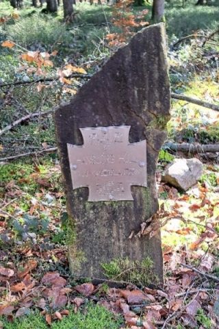
Gefallenenkreuz für Hansjörg Höll
Field Names
Im Winkel
Extraction and Processing of Raw Materials
Ehemaliger Steinbruch
Extraction and Processing of Raw Materials
Ehemaliger Steinbruch
Field Names