Extraction and Processing of Raw Materials · Renaissance
Glashütte
- Listed monument


© GeoBasis-DE / LVermGeoRP, dl-de/by-2-0
There is no picture of this object yet. Do you have a photo that you would like to make available to the Kulturdatenbank? Submit a picture
Description
This description is only available in German.
Translate with Google opens this page in Google Translate (external service)
[...] Älter als Damflos ist eine im Bistumswald an der Grenze zur Herrschaft Züsch 1600 vom Trierer Kurfürst genehmigte Glashütte, die 1619 zu einer Eisenhütte mit Schmelze und Hammer umgewandelt wurde und während des Dreißigjährigen Krieges unterging.
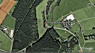
Daran erinnerte eine Malmühle [Gemarkung Hermeskeil] auf die der Name Schmelzmühle überging und die 1976 abgebrochen wurde. [1]
Classification
- Subject area
- Archaeological Monuments
- Category
- Economy, Trade and Transport
- Object type
- Extraction and Processing of Raw Materials
- Date
- 1600
- Period
- Renaissance
Location
- District
- Trier-Saarburg
- Collective municipality
- Hermeskeil
- Municipality
- Damflos
- Locality / location
- Mühlenhof
- Field name
- Wagnerswiese
- Coordinates
- WGS 84: 49.676549, 6.976510 (Position: presumed) WGS 84: 49° 40′ 35.6″ N, 6° 58′ 35.4″ E UTM 32 (ETRS89): E 354017 · N 5504635
Sources
Data sources
- [1] Denkmaltopographie Bundesrepublik Deutschland, Kulturdenkmäler in Rheinland-Pfalz, Kreis Trier-Saarburg, 12.1 Wernersche Verlagsgesellschaft 1994
On the internet
Last edited: 3 Jan 2006 Object ID: 10602
https://kulturdb.de/en/objekt/10602-damflos-glashuette
Nearby
The nearest objects
 120 m
Mills
Ehemalige Schmelzmühle
Field Names
Unterste Röder
Fortresses and Bunkers
Westwall - Maschinengewehr-Schartenstand
Field Names
Alt Röder am Weg
Mills
Ehemalige Sägemühle
Field Names
Untersten Großen Röder
Field Names
Unterm Breitenborn
Field Names