Wayside Shrines and Stations of the Cross · Neoclassicism
Wegekreuz
An der Feldkapelle am Flugplatz


© GeoBasis-DE / LVermGeoRP, dl-de/by-2-0
There is no picture of this object yet. Do you have a photo that you would like to make available to the Kulturdatenbank? Submit a picture
Description
This description is only available in German.
Translate with Google opens this page in Google Translate (external service)
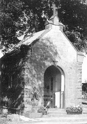
Rechts vom Eingang steht ein Wegekreuz mit einem kurzen, geschwungenen Schaft, darauf ein Engelskopf und die Jahreszahl 1817. [1]
Classification
- Subject area
- Architectural and Art Monuments
- Category
- Religious Buildings
- Object type
- Wayside Shrines and Stations of the Cross
- Date
- 1817
- Period
- Neoclassicism
Location
- District
- Bernkastel-Wittlich
- Collective municipality
- Wittlich-Land
- Municipality
- Binsfeld
- Field name
- Auf der untersten Först
- Coordinates
- WGS 84: 49.959028, 6.684641 (Position: exact) WGS 84: 49° 57′ 32.5″ N, 6° 41′ 04.7″ E UTM 32 (ETRS89): E 333932 · N 5536645
Sources
Data sources
- [1] Matthias Thömmes - Hermann Schmitz: Kirchen und Kapellen im Speicherer Land. Arbeitskreis für Heimatgeschichte und -literatur im Eifelverein Ortsgruppe Speicher. 2004. ISBN: 3-00-014814-0
On the internet
Last edited: 6 Nov 2003 Object ID: 10627
https://kulturdb.de/en/objekt/10627-binsfeld-wegekreuz
Nearby
The nearest objects
 less than 10 m
Wayside Shrine Houses
Binsfelder Heiligenhäuschen
Wayside Shrines and Stations of the Cross
Wegekreuz
Railways
Ehemaliger Bahnhof Herforst
Extraction and Processing of Raw Materials
Ehemalige Ziegelei
Field Names
Maarbuesch
Extraction and Processing of Raw Materials
Ehemaliger Tonabbau
Extraction and Processing of Raw Materials
Ehemaliger Tonabbau
Extraction and Processing of Raw Materials