Historic Townscapes · Neoclassicism
Denkmalzone Oberdorf
- Listed monument


Description
This description is only available in German.
Translate with Google opens this page in Google Translate (external service)
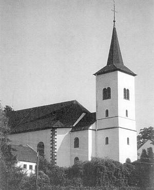
Der höher gelegene nördliche Teil des Ortes ist fast noch ungestört erhalten und wird deshalb als Denkmalzone ausgewiesen. Er umfaßt die Kirche mit dem sich nach Norden abstufenden Kirchhof eine private Kapelle, Gehöfte verschiedener Größen von 1785 bis in die Mitte des 19. Jahrhunderts sowie die 1931 / 32 vom Unterdorf hierher verlegte Schule.
Classification
- Subject area
- Architectural and Art Monuments
- Category
- Historic Townscapes
- Date
- 1785
- Period
- Neoclassicism
Location
- District
- Eifelkreis Bitburg-Prüm
- Collective municipality
- Bitburger Land
- Municipality
- Messerich
- Locality / location
- Oberdorf
- Field name
- Ober-Messerich
- Coordinates
- WGS 84: 49.939339, 6.481710 (Position: exact) WGS 84: 49° 56′ 21.6″ N, 6° 28′ 54.2″ E UTM 32 (ETRS89): E 319304 · N 5534926
Sources
Data sources
- Homepage der Initiative Region Trier e.V. Sehen & Erleben - Bau-Denkmäler http://www.regiontrier.de/cgi/bin
On the internet
bitburgerland.de/index.php?id=339
Picture credits
Last edited: 10 Jan 2006 Object ID: 10671
https://kulturdb.de/en/objekt/10671-messerich-denkmalzone-oberdorf
Nearby
The nearest objects
Town Houses and Commercial Buildings
Hofanlage
 40 m
Elms
Ulme an der Pfarrkirche
 40 m
Catholic Churches
Sankt Martin (1)
Settlements
Römische Fundamentreste
Catholic Churches
Sankt Martin (5)
Catholic Churches
Sankt Martin (4)
Catholic Churches
Sankt Martin (3)
Catholic Churches