Settlements · Celtic / Roman Period
Römische Siedlungsspuren am Gasthübel

Description
This description is only available in German.
Translate with Google opens this page in Google Translate (external service)
An der Straße Gransdorf - Spangdahlem, unmittelbar ostwärts der Höhe 372 Gasthübel, Distrikt Steinbüsch, sind Spuren einer größeren Siedlung. Etwa 500 Meter ostwärts, jenseits der alten Straße wurde 1924 ein römisches [keltisches- Anm. d. Red.] Gräberfeld aufgedeckt. [1]
Classification
- Subject area
- Archaeological Monuments
- Category
- Settlements
- Object type
- Settlements
- Date
- Circa 500 vor Chr. bis circa 500 nach Chr.
- Period
- Celtic / Roman Period
Location
- District
- Eifelkreis Bitburg-Prüm
- Collective municipality
- Speicher
- Municipality
- Spangdahlem
- Field name
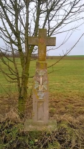
- Gasthübel beim Heidenkreuz
- Coordinates
- WGS 84: 50.006108, 6.690521 (Position: presumed) WGS 84: 50° 00′ 22.0″ N, 6° 41′ 25.9″ E UTM 32 (ETRS89): E 334515 · N 5541866
Sources
Data sources
- [1] Karl E. Becker: Das Kyllburger Land. Kyllburg 1977. Hrsg. Verbandsgemeinde Kyllburg.
On the internet
vg-speicher.de/gemeinden/spangdahlem
Picture credits
- Picture 1: © Lothar Monshausen, Fotostream http://www.flickr.com/photos/lomo56/tags/meteorite/
Last edited: 18 Apr 2006 Object ID: 10920
https://kulturdb.de/en/objekt/10920-spangdahlem-roemische-siedlungsspuren-am-gasthuebel
Nearby
The nearest objects
Settlements
Römische Siedlungsstelle
Field Names
Gasthübel ober dem Messenweg
Field Names
Am Messenweg
Cremation Graves
Römische Brandgräber
Field Names
Auf der Schlimmfuhr in den Aspeln
Field Names
In den Aspeln
 780 m
Wayside Shrines and Stations of the Cross
Wegekreuz
Settlements