Settlements · Celtic / Roman Period
Fränkische Hofgruppe


© GeoBasis-DE / LVermGeoRP, dl-de/by-2-0
There is no picture of this object yet. Do you have a photo that you would like to make available to the Kulturdatenbank? Submit a picture
Classification
- Subject area
- Archaeological Monuments
- Category
- Settlements
- Object type
- Settlements
- Date
- Ende des 5. Jahrhunderts
- Period
- Celtic / Roman Period
Location
- District
- Trier-Saarburg
- Collective municipality
- Trier-Land
- Municipality
- Ralingen
- Locality / location
- Wintersdorf
- Street
- Im Sauertal / Ringstraße
- Field name
- Ortslage
- Coordinates
- WGS 84: 49.788131, 6.509605 (Position: exact) WGS 84: 49° 47′ 17.3″ N, 6° 30′ 34.6″ E UTM 32 (ETRS89): E 320747 · N 5518050
Sources
Data sources
- Führer zu den vor- und frühgeschichtlichen Denkmälern.Band 33. Südwestliche Eifel. Hrsg.: Römisch-Germanisches Nationalmuseum, Mainz; 1977. ISBN 3-8053-0302-5
On the internet
Last edited: 7 Jul 2006 Object ID: 11150
https://kulturdb.de/en/objekt/11150-ralingen-fraenkische-hofgruppe
Nearby
The nearest objects
No picture
100 m
Walnut Trees
Walnussbäume
No picture
120 m
Fortresses and Bunkers
Westwall - MG-Dreifachschartenstand
No picture
140 m
Fortresses and Bunkers
Westwall - MG-Dreifachschartenstand
No picture
150 m
Field Names
In der Bornwies
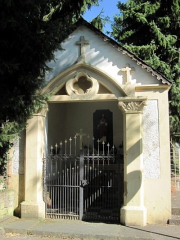 190 m
Chapels
Marienkapelle am Sauerufer
No picture
200 m
Railways
Ehemaliges Bahnhofsgebäude Wintersdorf
No picture
200 m
Lime Trees
Lindengruppe am ehemaligen Bahnhofsgebäude
No picture
230 m
Burial Mounds