Wayside Shrines and Stations of the Cross · Renaissance
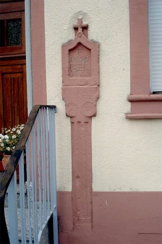
Nischenkreuz
- Listed monument


Description
This description is only available in German.
Translate with Google opens this page in Google Translate (external service)
Vollnischenkreuz vom Typ des Säulenkreuzes, inschriftlich datiert 1623. Fast identisch mit dem im selben Jahr entstandenen Vollnischenkreuz auf dem alten Kirchhof an der Pfarrkirche. Der Schaft als Säule mit breiten Kanneluren ausgebildet. Am oberen Schaftende, zu dessen quadratischem Querschnitt stilisierte Voluten überleiten, die wohl nachträglich angebrachten Initialen FIHP. In der kielförmig geschlossenen Vollnische ein Kelch in flachem Relief und die Initialen.
F[RIDRICH] J[ACOBUS] P[OT]
PASTOR IN D[ALEIDEN].
Das Abschlußkreuz mit Korpus in einfacher Steinmetzarbeit.
[1]
Classification
- Subject area
- Architectural and Art Monuments
- Category
- Religious Buildings
- Object type
- Wayside Shrines and Stations of the Cross
- Date
- 1623
- Period
- Renaissance
Location
- District
- Eifelkreis Bitburg-Prüm
- Collective municipality
- Arzfeld
- Municipality
- Daleiden
- Street
- Hauptstraße 22
- Field name
- Ortslage
- Coordinates
- WGS 84: 50.070023, 6.185595 (Position: exact) WGS 84: 50° 04′ 12.1″ N, 6° 11′ 08.1″ E UTM 32 (ETRS89): E 298607 · N 5550211
Sources
Data sources
- [1] Denkmaltopographie Bundesrepublik Deutschland, Kulturdenkmäler in Rheinland-Pfalz, Kreis Bitburg-Prüm, 9.3 Wernersche Verlagsgesellschaft Worms 2000 - ISBN 3-88462-170-X.
On the internet
Picture credits
Last edited: 8 Dec 2023 Object ID: 11270
https://kulturdb.de/en/objekt/11270-daleiden-nischenkreuz
Nearby
The nearest objects
Field Names
An dem Scheid
Farmhouses and Farm Buildings
Quereinhaus
 130 m
Wayside Shrines and Stations of the Cross
Wegekreuz
Wayside Shrines and Stations of the Cross
Kreuzwegstation
Chapels
Kapelle
Wayside Shrines and Stations of the Cross
Kreuzwegstation
Wayside Shrines and Stations of the Cross
Kreuzwegstation
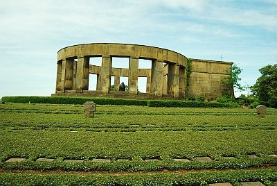 200 m
War Cemeteries