Burial Mounds · Undated
Einzelner Grabhügel
- Listed monument


© GeoBasis-DE / LVermGeoRP, dl-de/by-2-0
There is no picture of this object yet. Do you have a photo that you would like to make available to the Kulturdatenbank? Submit a picture
Description
This description is only available in German.
Translate with Google opens this page in Google Translate (external service)
Fundstelle 68
Einzelner Grabhügel unbekannter Zeitstellung nordöstlich von Dodenburg. In der Umgebung angeblich weitere Tumuli. Vergleiche auch unter Salmtal/Dörbach.
in: Römisch-Germanische Forschungen, Bd. 63. Eisenzeitlicher Kulturwandel und Romanisierung im Mosel-Eifel-Raum. Die keltisch-römische Siedlung von Wallendorf und ihr archäologisches Umfeld. Römisch-Germanische Kommission des Deutschen Archäologischen Instituts Frankfurt a. M. Fundstellenkatalog von: Dirk L. Krausse unter Mitarbeit von Antje Fischbock. 2006.
Classification
- Subject area
- Archaeological Monuments
- Category
- Burials
- Object type
- Burial Mounds
- Date
- Undatiert
- Period
- Undated
Location
- District
- Bernkastel-Wittlich
- Collective municipality
- Wittlich-Land
- Municipality
- Dodenburg
- Field name
- Im Jungenwald
- Coordinates
- WGS 84: 49.925343, 6.792176 (Position: exact) WGS 84: 49° 55′ 31.2″ N, 6° 47′ 31.8″ E UTM 32 (ETRS89): E 341533 · N 5532667
Sources
Data sources
- Fundstellenkatalog: Die keltisch-römische Siedlung von Wallendorf und ihr archäologisches Umfeld. Dirk L. Krausse unter Mitarbeit von Antje Fischbock. 2006
On the internet
Last edited: 1 Feb 2012 Object ID: 12170
https://kulturdb.de/en/objekt/12170-dodenburg-einzelner-grabhuegel
Nearby
The nearest objects
Burial Mounds
Grabhügel
Defensive Earthworks and Watchtowers
Quadratische Wallanlage
Field Names
Auf dem Wachsland
 630 m
Mineral Springs
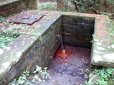
Sauerbrunnen - Mineralquelle im Hexengraben
 670 m
Settlements
Römische Siedlungsstelle
Fossils
Fundstellen tierischer Versteinerungen
Wayside Shrines and Stations of the Cross
Kreuz nahe dem Jägerhaus Waidmannsruh
Extraction and Processing of Raw Materials