Burial Mounds · Undated
Grabhügel
- Listed monument
© GeoBasis-DE / LVermGeoRP, dl-de/by-2-0
There is no picture of this object yet. Do you have a photo that you would like to make available to the Kulturdatenbank? Submit a picture
Description
This description is only available in German.
Translate with Google opens this page in Google Translate (external service)
Fundstelle 512
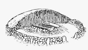
Beiderseits der Gemeindegrenze Gilzem - Meckel liegen auf Nordost-Südwest verlaufendem Höhenrücken 35 Grabhügel in zwei Gruppen. Die Zeitstellung der Nekropole ist unbekannt.
Steinhausen 1932, 180; Trierer Zeitschrift für Geschichte und Kunst des Trierer Landes und seiner Nachbargebiete 33, 1970, 210
in: Römisch-Germanische Forschungen, Bd. 63. Eisenzeitlicher Kulturwandel und Romanisierung im Mosel-Eifel-Raum. Die keltisch-römische Siedlung von Wallendorf und ihr archäologisches Umfeld. Römisch-Germanische Kommission des Deutschen Archäologischen Instituts Frankfurt a. M. Fundstellenkatalog von: Dirk L. Krausse unter Mitarbeit von Antje Fischbock. 2006
Classification
- Subject area
- Archaeological Monuments
- Category
- Burials
- Object type
- Burial Mounds
- Date
- Undatiert
- Period
- Undated
Location
- District
- Eifelkreis Bitburg-Prüm
- Collective municipality
- Bitburger Land
- Municipality
- Meckel
- Field name
- In der Hardt
- Coordinates
- WGS 84: 49.880820, 6.534804 (Position: exact) WGS 84: 49° 52′ 51.0″ N, 6° 32′ 05.3″ E UTM 32 (ETRS89): E 322899 · N 5528294
Sources
Data sources
- - Fundstellenkatalog: Die keltisch-römische Siedlung von Wallendorf und ihr archäologisches Umfeld. Dirk L. Krausse unter Mitarbeit von Antje Fischbock, 2006.
- - Dirk Krausse: Eisenzeitlicher Kulturwandel und Romanisierung im Mosel-Eifel-Raum. Verlag: Philipp von Zabern, Mainz, 2006. Beilage 1.
On the internet
Last edited: 3 Feb 2012 Object ID: 12637
https://kulturdb.de/en/objekt/12637-meckel-grabhuegel