Standing Stones, Menhirs · Prehistory / Early History
Menhir in römischer Mauer
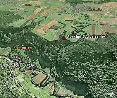
Laisenhof


© GeoBasis-DE / LVermGeoRP, dl-de/by-2-0
There is no picture of this object yet. Do you have a photo that you would like to make available to the Kulturdatenbank? Submit a picture
Description
This description is only available in German.
Translate with Google opens this page in Google Translate (external service)
[...] Ein "großer, teilweise behauener Monolith (von 185 m Länge, 0,65 m Breite, und 0,35m Durchmesser)" befand sich in einer Mauer der von Bone 1879 teilweise ausgegrabenen römischen Villa beim Laisenhof, "der Bone an die auch sonst auf der Hochfläche beobachteten 'Menhire' erinnerte" (Steinhausen 1932, 106).
[...]
Der Menhir ist zerstört, oder nicht mehr lokalisierbar.
Classification
- Subject area
- Archaeological Monuments
- Category
- Standing Stones, Menhirs
- Date
- Bis circa 500 vor Chr.
Location
- District
- Eifelkreis Bitburg-Prüm
- Collective municipality
- Südeifel
- Municipality
- Prümzurlay
- Locality / location
- Laisenhof
- Field name
- Im Tiergarten
- Coordinates
- WGS 84: 49.869482, 6.421631 (Position: presumed) WGS 84: 49° 52′ 10.1″ N, 6° 25′ 17.9″ E UTM 32 (ETRS89): E 314727 · N 5527308
Sources
Data sources
- [1] Volker Kneidl: Die "Nusbaumer Menhire" auf dem Ferschweiler Plateau, Kreis Bitburg-Prüm; in: Trierer Zeitschrift 67/68 - 2004/05 (Gedenkschrift für Heinz Cüppers). Hrsg.: Rheinisches Landesmuseum Trier. Online-Shop: www.landesmuseum-trier-shop.de und https://journals.ub.uni-heidelberg.de/index.php/tz/article/download…
On the internet
Last edited: 24 Sep 2022 Object ID: 12734
https://kulturdb.de/en/objekt/12734-pruemzurlay-menhir-in-roemischer-mauer
Nearby
The nearest objects
 100 m
Field Names
Im Tiergarten
140 m
Field Names
Auf dem Tiergarten
150 m
Field Names
Im Tiergarten
Field Names
In der Aspelheck
Find Sites
Keramik-, Schlacke- und Metallfunde
260 m
Field Names
Unterm Tiergarten
 270 m
Natural Fortresses
Ferschweiler Plateau - Laisenhof
Field Names