Wayside Shrines and Stations of the Cross · 20th Century
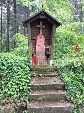
Anton-Bauer-Kreuz


Description
This description is only available in German.
Translate with Google opens this page in Google Translate (external service)
Classification
- Subject area
- Architectural and Art Monuments
- Category
- Religious Buildings
- Object type
- Wayside Shrines and Stations of the Cross
- Date
- Nach 1932
- Period
- 20th Century
Location
- District
- Trier-Saarburg
- Collective municipality
- Schweich an der römischen Weinstraße
- Town
- Schweich
- Field name
- Warmbrunnen
- Coordinates
- WGS 84: 49.878484, 6.722333 (Position: exact) WGS 84: 49° 52′ 42.5″ N, 6° 43′ 20.4″ E UTM 32 (ETRS89): E 336362 · N 5527608
Sources
Data sources
- [1] Reuter, Thömmes: Die Fidei. Band 2. Hrsg.: Arbeitskreis für Heimatgeschichte und Literatur im Eifelverein e.V. / Ortsgruppe Speicher. 2006
- [2] Mitteilung von Wolfgang Welter, Schweich, 2024 - Quellenangabe: https://philatelisten-verein.de/media/bernkastel_1949_lambert_hiero…, abgerufen am 05.02.2024.
On the internet
Picture credits
Last edited: 20 Mar 2024 Object ID: 13487
https://kulturdb.de/en/objekt/13487-schweich-anton-bauer-kreuz
Nearby
The nearest objects
 200 m
Charcoal Kilns
Ehemaliger Meilerplatz
 230 m
Field Names
Warmbrunnen
290 m
Charcoal Kilns
Ehemaliger Meilerplatz
300 m
Charcoal Kilns
Ehemaliger Meilerplatz
 400 m
Wayside Shrines and Stations of the Cross
Blankenheimer Kreuz im Meulenwald
480 m
Charcoal Kilns
Ehemaliger Meilerplatz
No picture
490 m
Field Names
Pfaffenloch
No picture
610 m
Field Names