Cremation Graves · Celtic / Roman Period
Tonurnen


© GeoBasis-DE / LVermGeoRP, dl-de/by-2-0
There is no picture of this object yet. Do you have a photo that you would like to make available to the Kulturdatenbank? Submit a picture
Description
This description is only available in German.
Translate with Google opens this page in Google Translate (external service)
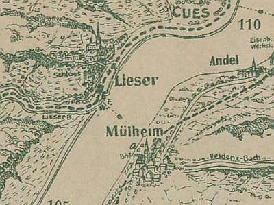
[...] An der Liesermündung, am Fuße des Brauneberges, fanden sich zwei Tonurnen, mit Asche gefüllt. [1]
Classification
- Subject area
- Archaeological Monuments
- Category
- Burials
- Object type
- Cremation Graves
- Date
- Circa 500 vor Chr. bis circa 500 nach Chr.
- Period
- Celtic / Roman Period
Location
- District
- Bernkastel-Wittlich
- Collective municipality
- Bernkastel-Kues
- Municipality
- Lieser
- Field name
- Unter der Lay
- Coordinates
- WGS 84: 49.916532, 7.008461 (Position: presumed) WGS 84: 49° 54′ 59.5″ N, 7° 00′ 30.5″ E UTM 32 (ETRS89): E 357030 · N 5531252
Sources
Data sources
- [1] Die Kunstdenkmäler der Rheinprovinz. Bd. 15. Die Kunstdenkmäler des Kreises Bernkastel, (1935).
On the internet
Last edited: 17 Jan 2008 Object ID: 13839
https://kulturdb.de/en/objekt/13839-lieser-tonurnen
Nearby
The nearest objects
Chapels
Kapelle
 250 m
Ferries
Ehemalige Fähre
Vineyard Sites
Im Bunenwingert
Field Names
Mühlenrech
Railways
Moseltalbahn - Ehemaliger Bahnhof
Field Names
Mühlenrech
Mills
Ehemalige Mühle
Rectories