Wayside Shrines and Stations of the Cross · Historicism / Art Nouveau
Schaftkreuz


© GeoBasis-DE / LVermGeoRP, dl-de/by-2-0
There is no picture of this object yet. Do you have a photo that you would like to make available to the Kulturdatenbank? Submit a picture
Description
This description is only available in German.
Translate with Google opens this page in Google Translate (external service)
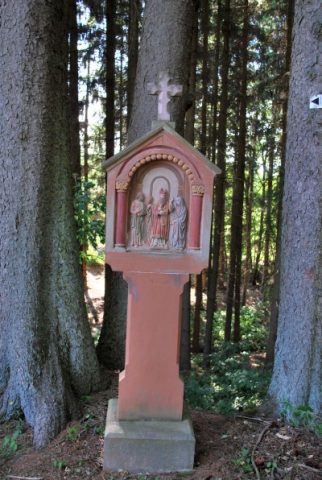
Wegekreuz am östlichen Ortsausgang von Buchholz. Schlankes Schaftkreuz in barocker Tradition, bezeichnet 1871.
Classification
- Subject area
- Architectural and Art Monuments
- Category
- Religious Buildings
- Object type
- Wayside Shrines and Stations of the Cross
- Date
- 1871
Location
- District
- Bernkastel-Wittlich
- Collective municipality
- Wittlich-Land
- Municipality
- Pantenburg
- Locality / location
- Buchholz
- Field name
- Im Gillenfelder Feld
- Coordinates
- WGS 84: 50.099728, 6.838779 (Position: exact) WGS 84: 50° 05′ 59.0″ N, 6° 50′ 19.6″ E UTM 32 (ETRS89): E 345439 · N 5551956
Sources
Data sources
- [1] Elisabeth Steffes: Bildstöcke, Wegekreuze und Heiligenhäuschen in der Verbandsgemeinde Manderscheid/Vulkaneifel , 1993.
On the internet
pfarreiengemeinschaft-manderscheid.de/Buchholz/Buchholz-Historie.html
Last edited: 18 Dec 2008 Object ID: 15008
https://kulturdb.de/en/objekt/15008-pantenburg-schaftkreuz
Nearby
The nearest objects
Wayside Shrines and Stations of the Cross
Wegekreuz
 100 m
Market Towns
Marktort Buchholz
 110 m
Wayside Shrines and Stations of the Cross
Bildstockweg (2)
120 m
Wayside Shrines and Stations of the Cross
Bildstockweg (3)
Viewpoints
Aussichtspunkt Klosterkirche Buchholz
Wayside Shrines and Stations of the Cross
Kreuzweg mit 14 Stationen (13)
Field Names
Beim Buchholz
Wayside Shrines and Stations of the Cross