Farmhouses and Farm Buildings · Renaissance
Ehemaliger Zweiseithof Retzgrubenweg 6
- Listed monument


Description
This description is only available in German.
Translate with Google opens this page in Google Translate (external service)
Walmdachbau auf hohem Kellersockel, bezeichnet 1628, ehemaliger Wirtschaftsflügel wohl aus dem 19. Jahrhundert. [1]
Classification
- Subject area
- Architectural and Art Monuments
- Category
- Residential and Farm Buildings
- Object type
- Farmhouses and Farm Buildings
- Date
- 1628
- Period
- Renaissance
Location
- District
- City of Trier
- Collective municipality
- Verbandsfreie Gemeinde Trier
- Town
- Trier
- Locality / location
- Olewig
- Street
- Retzgrubenweg 6
- Field name
- In der Retzgrub
- Coordinates
- WGS 84: 49.744335, 6.660974 (Position: exact) WGS 84: 49° 44′ 39.6″ N, 6° 39′ 39.5″ E UTM 32 (ETRS89): E 331489 · N 5512831
Sources
Data sources
- [1] Denkmalliste der Generaldirektion Kulturelles Erbe, Rheinland-Pfalz; 2009.
On the internet
de.wikipedia.org/wiki/Trier-Olewig
Picture credits
Last edited: 18 Feb 2023 Object ID: 16858
https://kulturdb.de/en/objekt/16858-trier-ehemaliger-zweiseithof-retzgrubenweg-6
Nearby
The nearest objects
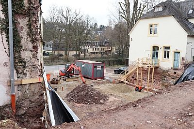 10 m
Town Houses and Commercial Buildings
Ehemaliges Haus Retzgrubenweg 8
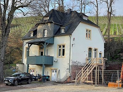 30 m
Town Houses and Commercial Buildings
Winzervilla Retzgrubenweg 10
 70 m
Lime Trees
Linde, Retzgrubenweg
70 m
Ash Trees
Esche
80 m
Oaks
Eiche
80 m
Lime Trees
Linde, Retzgrubenweg
Schools
Ehemalige Schule
160 m
Oaks