Wayside Shrines and Stations of the Cross · Undated
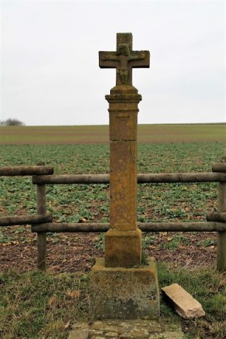
Dankeskreuz an der Straße nach Orsfeld


Description
This description is only available in German.
Translate with Google opens this page in Google Translate (external service)
Classification
- Subject area
- Architectural and Art Monuments
- Category
- Religious Buildings
- Object type
- Wayside Shrines and Stations of the Cross
- Date
- Undatiert
- Period
- Undated
- Creator, builder, architect, artist
- Heinen
Location
- District
- Eifelkreis Bitburg-Prüm
- Collective municipality
- Bitburger Land
- Municipality
- Oberkail
- Field name
- Ober der Flur am Malbergerweg
- Coordinates
- WGS 84: 50.037381, 6.665536 (Position: exact) WGS 84: 50° 02′ 14.6″ N, 6° 39′ 55.9″ E UTM 32 (ETRS89): E 332834 · N 5545398
Sources
Data sources
- [1] Erich Gerten, Jörg Kreutz und Claus Rech: "Oberkail Geschichte eines Dorfes in der südlichen Eifel".
- [2] Sandra Wack, Neuheilenbach, 2020. www.koerbchen-gesucht.de
On the internet
Picture credits
- Picture 1: © Sandra Wack, Neuheilenbach, 2020. www.koerbchen-gesucht.de
- Picture 2: © Sandra Wack, Neuheilenbach, 2020. www.koerbchen-gesucht.de
- Picture 3: © Sandra Wack, Neuheilenbach, 2020. www.koerbchen-gesucht.de
- Picture 4: © Sandra Wack, Neuheilenbach, 2020. www.koerbchen-gesucht.de
- Picture 5: © Sandra Wack, Neuheilenbach, 2020. www.koerbchen-gesucht.de
- Picture 6: © Sandra Wack, Neuheilenbach, 2020. www.koerbchen-gesucht.de
Last edited: 22 Mar 2020 Object ID: 17251
https://kulturdb.de/en/objekt/17251-oberkail-dankeskreuz-an-der-strasse-nach-orsfeld
Nearby
The nearest objects
No picture
400 m
Field Names
Lehmkaul
No picture
450 m
Field Names
Am untersten Grund
No picture
550 m
Field Names
Steinkaul
No picture
560 m
Surveying
Trigonometrisches Signal
 580 m
Wayside Shrines and Stations of the Cross
Wegekreuz südöstlich des Leisenhofes (1)
 580 m
Wayside Shrines and Stations of the Cross
Wegekreuz südöstlich des Leisenhofes (2)
No picture
710 m
Mills
Ehemalige Mühle am Kailbach
No picture
860 m
Field Names