Chapels · Historicism / Art Nouveau
Feldkapelle
- Listed monument


Description
This description is only available in German.
Translate with Google opens this page in Google Translate (external service)
An der Kreisstraße 60 westlich der Ortslage, gegenüber dem Neubaugebiet: Wegekapelle; Putzbau, um 1900. [1]
Classification
- Subject area
- Architectural and Art Monuments
- Category
- Religious Buildings
- Object type
- Chapels
- Date
- Um 1900
Location
- District
- Trier-Saarburg
- Collective municipality
- Ruwer
- Municipality
- Korlingen
- Street
- Romikastraße
- Field name
- Ober dem Straßengarten
- Coordinates
- WGS 84: 49.725001, 6.718823 (Position: exact) WGS 84: 49° 43′ 30.0″ N, 6° 43′ 07.8″ E UTM 32 (ETRS89): E 335591 · N 5510553
Sources
Data sources
- [1] Denkmalliste der Generaldirektion Kulturelles Erbe, Rheinland-Pfalz; 2010.
On the internet
Picture credits
Last edited: 5 Aug 2012 Object ID: 1770
https://kulturdb.de/en/objekt/1770-korlingen-feldkapelle
Nearby
The nearest objects
No picture
50 m
Extraction and Processing of Raw Materials
Versuch auf Bleierz und Blende
No picture
180 m
Field Names
Ober den Werkstückern
No picture
200 m
Field Names
Im Umkehrenweg
No picture
200 m
Field Names
Hinterste Anwand im mittelsten Flur
No picture
260 m
Field Names
Mittelste Anwand im Neuenflur
No picture
350 m
Field Names
Die mittelste Anwand im geteilten Flur
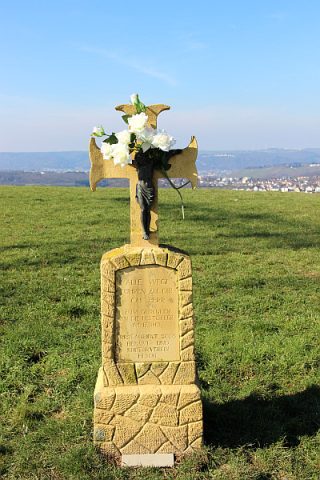 390 m
Wayside Shrines and Stations of the Cross
Pestkreuz am Galgenkopf
No picture
400 m
Field Names