Settlements · Celtic / Roman Period
Römische Siedlung

Description
This description is only available in German.
Translate with Google opens this page in Google Translate (external service)
Auf der Gemarkung weisen Siedlungsspuren bis in die römische Zeit zurück.
Classification
- Subject area
- Archaeological Monuments
- Category
- Settlements
- Object type
- Settlements
- Date
- Circa 500 vor Chr. bis circa 500 nach Chr.
- Period
- Celtic / Roman Period
Location
- District
- Trier-Saarburg
- Collective municipality
- Konz
- Municipality
- Onsdorf
- Field name
- Ortslage
- Coordinates
- WGS 84: 49.644509, 6.482377 (Position: within the village) WGS 84: 49° 38′ 40.2″ N, 6° 28′ 56.6″ E UTM 32 (ETRS89): E 318252 · N 5502151
Sources
Data sources
- Homepage von Verbandsgemeinde und Stadt Konz
On the internet
Picture credits
- Picture 1: © Lothar Monshausen, Fotostream http://www.flickr.com/photos/lomo56/tags/meteorite/
Last edited: 7 Oct 2003 Object ID: 1939
https://kulturdb.de/en/objekt/1939-onsdorf-roemische-siedlung
Nearby
The nearest objects
 less than 10 m
Place Names / Local History
Erste Erwähnung als Omestorff
No picture
less than 10 m
Wayside Shrines and Stations of the Cross
Wetterkreuz
 100 m
Field Names
Hanfgarten
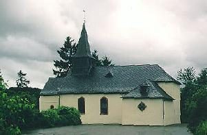 140 m
Catholic Churches
Sankt Hubertus
No picture
160 m
Field Names
Im nassen Garten
No picture
240 m
Vineyard Sites
Hubertusberg
No picture
250 m
Chapels
Kapelle
No picture
370 m
Vineyard Sites