Wayside Shrines and Stations of the Cross · Baroque / Rococo
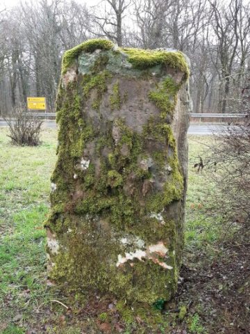
Kuhfeltes Kreuz

Description
This description is only available in German.
Translate with Google opens this page in Google Translate (external service)
Das "Kuhfeltes Kreuz" wurde im Jahr 1753 errichtet und erinnert an einen Kuhhirten der an dieser Stelle ums Leben kam. Im Jahr 2003 wurde das Kreuz erneuert. [1]
Classification
- Subject area
- Architectural and Art Monuments
- Category
- Religious Buildings
- Object type
- Wayside Shrines and Stations of the Cross
- Date
- 1753
- Period
- Baroque / Rococo
Location
- District
- Eifelkreis Bitburg-Prüm
- Collective municipality
- Verbandsfreie Gemeinde Bitburg
- Town
- Bitburg
- Field name
- Bethardt
- Coordinates
- WGS 84: 49.969396, 6.463612 (Position: exact) WGS 84: 49° 58′ 09.8″ N, 6° 27′ 49.0″ E UTM 32 (ETRS89): E 318119 · N 5538311
Sources
Data sources
- [1] Eifel-Scouts in: http://www.geocaching.com/seek/cache_details.aspx?wp=GC1X97P
On the internet
Picture credits
- Picture 1: outcast5 in: http://www.geocaching.com/seek/cache_details.aspx?wp=GC1X97P
Last edited: 27 Nov 2011 Object ID: 23875
https://kulturdb.de/en/objekt/23875-bitburg-kuhfeltes-kreuz
Nearby
The nearest objects
Burial Mounds
Grabhügel
Burial Mounds
Grabhügel
 310 m
Settlements
Römische Siedlung
Commemorative Plantings
Ehemaliger Bunepartsgarten
Wayside Shrines and Stations of the Cross
Wegekreuz
Field Names
Hungerkopf
 960 m
Monuments
Befreiungsstein
1.1 km
Settlements