Wayside Shrines and Stations of the Cross · 20th Century
Kreuzweg zur Laurentiuskapelle - 5. Station


© GeoBasis-DE / LVermGeoRP, dl-de/by-2-0
There is no picture of this object yet. Do you have a photo that you would like to make available to the Kulturdatenbank? Submit a picture
Description
This description is only available in German.
Translate with Google opens this page in Google Translate (external service)
Nach dem zweiten Weltkrieg gewann die Kapelle auch wieder eine stärkere Einbindung in das religiöse Leben der Gemeinde. Dazu trug sicher auch die Einweihung eines neuen Kreuzweges vom Dorf zur Kapelle hin bei. Dieser war von dem in Trittenheim gebürtigen Domkapitular Kaspar Kranz im August 1947 konsekriert worden. Damit schloß sich wieder ein Kreis einer früheren Tradition, als die Bildstöcke (Pestkreuze) des Jahres 1654 vom Ort zur Kapelle hinauf den Prozessionsweg begleiteten. [1]
Classification
- Subject area
- Architectural and Art Monuments
- Category
- Religious Buildings
- Object type
- Wayside Shrines and Stations of the Cross
- Date
- 1947
- Period
- 20th Century
Location
- District
- Trier-Saarburg
- Collective municipality
- Schweich an der römischen Weinstraße
- Municipality
- Trittenheim
- Field name
- Im Gombelter
- Coordinates
- WGS 84: 49.820383, 6.892297 (Position: exact) WGS 84: 49° 49′ 13.4″ N, 6° 53′ 32.3″ E UTM 32 (ETRS89): E 348391 · N 5520791
Sources
Data sources
- [1] Christoph Schmitt: Festschrift zur Laurentiuskapelle
On the internet
Last edited: 30 Dec 2011 Object ID: 23928
https://kulturdb.de/en/objekt/23928-trittenheim-kreuzweg-zur-laurentiuskapelle-5-station
Nearby
The nearest objects
Wayside Shrines and Stations of the Cross
Kreuzweg zur Laurentiuskapelle - 6. Station
Wayside Shrines and Stations of the Cross
Kreuzweg zur Laurentiuskapelle - 4. Station
Wayside Shrines and Stations of the Cross
Kreuzweg zur Laurentiuskapelle - 7. Station
Wayside Shrines and Stations of the Cross
Kreuzweg zur Laurentiuskapelle - 3. Station
Vineyard Sites
Altärchen
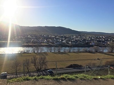 300 m
Viewpoints
Aussichtspunkt Laurentiuskapelle
Field Names
Zwergfeld
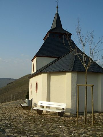 310 m
Chapels