Natural Landscapes · 20th Century
Malerwinkel


© GeoBasis-DE / LVermGeoRP, dl-de/by-2-0
There is no picture of this object yet. Do you have a photo that you would like to make available to the Kulturdatenbank? Submit a picture
Description
This description is only available in German.
Translate with Google opens this page in Google Translate (external service)
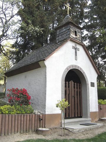
Wie für die Rapperather Mariensäule, so hat man auch in Bischofsdhron für eine Kapelle einen besonderen, außerhalb des Dorfes erhöht gelegenen Platz ausgewählt. Von hier aus, oberhalb der Straße nach Hundheim, hat man trotz eines kleinen Waldes einen recht guten Blick auf das Dhrontal und auf Bischofsdhron mit der Sankt-Paulinus-Kirche in der Dorfmitte.
Auch der Morbacher Maler Terwei nutzte vor dem Zweiten Weltkrieg diese Stelle, um seine Ansicht(en) von Bischofsdhron zu malen. Nicht umsonst wird dieses Fleckchen Erde "Malerwinkel" genannt.
[http://pfarreiengemeinschaft-morbach.de/von-turm-zu-turm/fatimakape…]
Zum Maler Wilhelm Terwei siehe: http://www.terwei.de/index.html
[Redaktion]
Classification
- Subject area
- Natural Features
- Category
- Natural Landscapes
- Date
- 1954
- Period
- 20th Century
- Creator, builder, architect, artist
- Weber, Peter
Location
- District
- Bernkastel-Wittlich
- Collective municipality
- Einheitsgemeinde Morbach
- Municipality
- Morbach
- Locality / location
- Bischofsdhron
- Field name
- Unterm Bruch
- Coordinates
- WGS 84: 49.823115, 7.147548 (Position: exact) WGS 84: 49° 49′ 23.2″ N, 7° 08′ 51.2″ E UTM 32 (ETRS89): E 366758 · N 5520610
Sources
Data sources
On the internet
pfarreiengemeinschaft-morbach.de/von-turm-zu-turm/fatimakapelle-in-bischofsdhron.html
Last edited: 5 Apr 2012 Object ID: 24294
https://kulturdb.de/en/objekt/24294-morbach-malerwinkel
Nearby
The nearest objects
 10 m
Chapels
Fatima-Kapelle
Wayside Shrines and Stations of the Cross
Kreuzweg zur Fatima-Kapelle - 14. Station
Wayside Shrines and Stations of the Cross
Kreuzweg zur Fatima-Kapelle - 5. Station
Wayside Shrines and Stations of the Cross
Kreuzweg zur Fatima-Kapelle - 4. Station
Wayside Shrines and Stations of the Cross
Kreuzweg zur Fatima-Kapelle - 13. Station
Wayside Shrines and Stations of the Cross
Kreuzweg zur Fatima-Kapelle - 3. Station
Wayside Shrines and Stations of the Cross
Kreuzweg zur Fatima-Kapelle - 6. Station
Wayside Shrines and Stations of the Cross