Rocks · 20th Century
Tanzlei - Felsen
Naturdenkmal
- Listed monument

Description
This description is only available in German.
Translate with Google opens this page in Google Translate (external service)
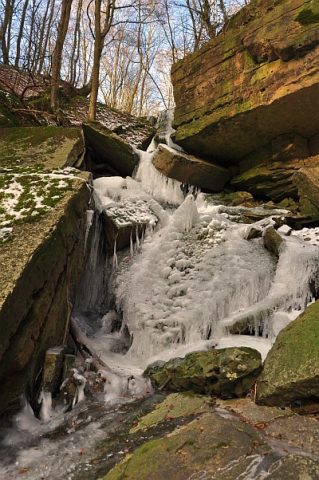
Versteckt im Wald, am idyllisch, romantischen Fußweg vom Parkplatz beim Hüttinger Friedhof nach Mötsch gelegen, stürzt sich der Daufenbach über riesige Sandsteinplatten den Berg herunter. Die Schlucht und das Naturdenlmal "Tanzlay bei Hüttingen/Kyll" ist ein beliebtes Ausflugsziel und ein interessantes Naturschauspiel. [1]
Classification
- Subject area
- Natural Features
- Category
- Rocks
- Date
- 01.02.1978 [Unterschutzstellung]
- Period
- 20th Century
Location
- District
- Eifelkreis Bitburg-Prüm
- Collective municipality
- Bitburger Land
- Municipality
- Hüttingen an der Kyll
- Field name
- Kalkhütchen
- Coordinates
- WGS 84: 49.964297, 6.580923 (Position: exact) WGS 84: 49° 57′ 51.5″ N, 6° 34′ 51.3″ E UTM 32 (ETRS89): E 326512 · N 5537466
Sources
Data sources
- [1] Lothar Monshausen, Fotostream http://www.flickr.com/photos/lomo56/tags/meteorite/
- [2] Liste der Naturdenkmäler im Landkreis Bitburg-Prüm
On the internet
de.wikipedia.org/wiki/H%C3%BCttingen_an_der_Kyll
Picture credits
- Picture 1: Peter Valerius, Kordel, 2005.
Last edited: 17 Feb 2012 Object ID: 24586
https://kulturdb.de/en/objekt/24586-huettingen-an-der-kyll-tanzlei-felsen
Nearby
The nearest objects
 20 m
Waterfalls
Tanzlay
Field Names
Kalkhütchen
Field Names
Rodenhold
Field Names
Heiligenfeld
Field Names
Im Junkerbaum
 480 m
Railways
Eifelbahn (Denkmalzone)
Field Names
Auf dem Kalkofen
 660 m
Wayside Shrines and Stations of the Cross