Rocks · Undated
Klingelfels


© GeoBasis-DE / LVermGeoRP, dl-de/by-2-0
There is no picture of this object yet. Do you have a photo that you would like to make available to the Kulturdatenbank? Submit a picture
Classification
- Subject area
- Natural Features
- Category
- Rocks
- Date
- Undatiert
- Period
- Undated
Location
- District
- Trier-Saarburg
- Collective municipality
- Saarburg-Kell
- Municipality
- Kirf
- Locality / location
- Meurich
- Field name
- Klingelfels
- Coordinates
- WGS 84: 49.560062, 6.524310 (Position: exact) WGS 84: 49° 33′ 36.2″ N, 6° 31′ 27.5″ E UTM 32 (ETRS89): E 320970 · N 5492663
Sources
Data sources
- [1] GeoPortal des Landes Rheinland-Pfalz. http://www.geoportal.rlp.de/
On the internet
saarburg-kell.de/saarburg_kell/Leben%20bei%20uns/Ortsgemeinden/Kirf
Last edited: 23 Aug 2012 Object ID: 24968
https://kulturdb.de/en/objekt/24968-kirf-klingelfels
Nearby
The nearest objects
No picture
340 m
Field Names
In Müllers Bungert
No picture
350 m
Mills
Oberste Neumühle am Leukbach
No picture
450 m
Field Names
Breitwiese
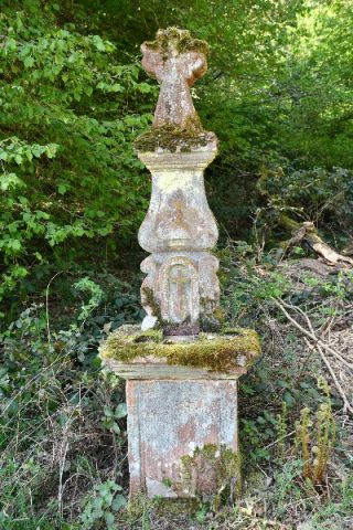 520 m
Altars
Altarkreuz an der obersten Neumühle
No picture
600 m
Mills
Unterste Neumühle am Leukbach
No picture
640 m
Field Names
Kondelborn
No picture
750 m
Field Names
Kalkeswies
No picture
840 m
Field Names