Wayside Shrines and Stations of the Cross · Renaissance
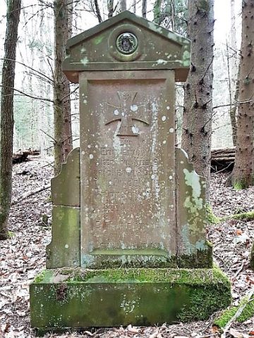
Balkenkreuz von 1601
- Listed monument


Description
This description is only available in German.
Translate with Google opens this page in Google Translate (external service)
Wegekreuz aus rötlichem Sandstein. [1]
Classification
- Subject area
- Architectural and Art Monuments
- Category
- Religious Buildings
- Object type
- Wayside Shrines and Stations of the Cross
- Date
- 1601
- Period
- Renaissance
Location
- District
- Eifelkreis Bitburg-Prüm
- Collective municipality
- Bitburger Land
- Municipality
- Dudeldorf
- Field name
- Aufm Ereck
- Coordinates
- WGS 84: 49.965730, 6.668480 (Position: exact) WGS 84: 49° 57′ 56.6″ N, 6° 40′ 06.5″ E UTM 32 (ETRS89): E 332796 · N 5537426
Sources
Data sources
- [1] Denkmaltopographie Bundesrepublik Deutschland, Kulturdenkmäler in Rheinland-Pfalz, Kreis Bitburg-Prüm, 9.2 Wernersche Verlagsgesellschaft 1994. ISBN 3-88462-132-7
On the internet
Picture credits
- Picture 1: © Sandra Wack, Neuheilenbach, 2021. www.koerbchen-gesucht.de
- Picture 2: © Sandra Wack, Neuheilenbach, 2021. www.koerbchen-gesucht.de
- Picture 3: © Sandra Wack, Neuheilenbach, 2021. www.koerbchen-gesucht.de
- Picture 4: © Sandra Wack, Neuheilenbach, 2021. www.koerbchen-gesucht.de
- Picture 5: © Sandra Wack, Neuheilenbach, 2021. www.koerbchen-gesucht.de
- Picture 6: © Sandra Wack, Neuheilenbach, 2021. www.koerbchen-gesucht.de
Last edited: 30 Jun 2021 Object ID: 25371
https://kulturdb.de/en/objekt/25371-dudeldorf-balkenkreuz-von-1601
Nearby
The nearest objects
 30 m
War Memorials
Gefallenendenkmal
No picture
290 m
Railways
Ehemaliger Haltepunkt Dudeldorf
 370 m
Settlements
Römische Siedlungsstelle
No picture
380 m
Extraction and Processing of Raw Materials
Ehemaliger Steinbruch
No picture
380 m
Field Names
In der Auelbach
No picture
410 m
Castles
Hinkelsburg
590 m
Settlements
Römische Siedlungsstelle
630 m
Settlements