Wayside Shrine Houses · Undated
Bildstock am Hirtenhof (1)


Description
This description is only available in German.
Translate with Google opens this page in Google Translate (external service)
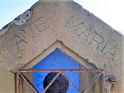
Inschrift auf dem oberen Nischenrand:
AVE MARIA [1]
Classification
- Subject area
- Architectural and Art Monuments
- Category
- Religious Buildings
- Object type
- Wayside Shrine Houses
- Date
- Undatiert
- Period
- Undated
Location
- District
- Eifelkreis Bitburg-Prüm
- Collective municipality
- Prüm
- Municipality
- Büdesheim
- Locality / location
- Hirtenhof
- Street
- Bei Hirtenhof 1
- Field name
- Auf den Hirten
- Coordinates
- WGS 84: 50.224652, 6.562047 (Position: exact) WGS 84: 50° 13′ 28.7″ N, 6° 33′ 43.4″ E UTM 32 (ETRS89): E 326104 · N 5566453
Sources
Data sources
On the internet
eifeldorf-buedesheim.de/index.html
Picture credits
- Picture 1: © Sandra Wack, Neuheilenbach, 2021. www.koerbchen-gesucht.de
- Picture 2: © Sandra Wack, Neuheilenbach, 2021. www.koerbchen-gesucht.de
- Picture 3: © Sandra Wack, Neuheilenbach, 2021. www.koerbchen-gesucht.de
- Picture 4: © Sandra Wack, Neuheilenbach, 2021. www.koerbchen-gesucht.de
- Picture 5: © Sandra Wack, Neuheilenbach, 2021. www.koerbchen-gesucht.de
- Picture 6: © Sandra Wack, Neuheilenbach, 2021. www.koerbchen-gesucht.de
Last edited: 10 Mar 2021 Object ID: 25419
https://kulturdb.de/en/objekt/25419-buedesheim-bildstock-am-hirtenhof-1
Nearby
The nearest objects
 less than 10 m
Wayside Shrine Houses
Bildstock am Hirtenhof (2)
No picture
70 m
Settlements
Römisches Mauerwerk
No picture
140 m
Wayside Shrine Houses
Kreuz vor dem Hirtenhof
No picture
520 m
Field Names
Auf der Hormesdell
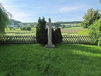 620 m
Wayside Shrines and Stations of the Cross
Balkenkreuz
No picture
690 m
Field Names
Im Kunertsborn
No picture
700 m
Aviation
Ehemaliger Feldflugplatz
No picture
760 m
Wayside Shrines and Stations of the Cross