Wayside Shrines and Stations of the Cross · Baroque / Rococo
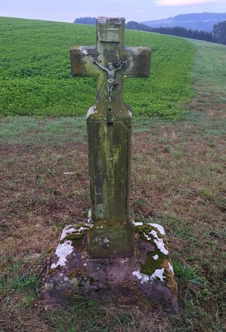
Kreuzwegstation
- Listed monument


© GeoBasis-DE / LVermGeoRP, dl-de/by-2-0
There is no picture of this object yet. Do you have a photo that you would like to make available to the Kulturdatenbank? Submit a picture
Description
This description is only available in German.
Translate with Google opens this page in Google Translate (external service)
Von der Ortsmitte Sefferns (am Rand des Neubaugebietes Am Weicherberg) über die Landesstraße 34 zur westlich von Sefferweich gelegenen Kapelle: Kreuzweg und Kapelle; barocke Kreuzwegstationen, zweite Hälfte des 18. Jahrhunderts, 14. Station in der kleinen kubischen Kapelle. [1]
Classification
- Subject area
- Architectural and Art Monuments
- Category
- Religious Buildings
- Object type
- Wayside Shrines and Stations of the Cross
- Date
- Zweite Hälfte des 18. Jahrhunderts
- Period
- Baroque / Rococo
Location
- District
- Eifelkreis Bitburg-Prüm
- Collective municipality
- Bitburger Land
- Municipality
- Seffern
- Field name
- Im Weichertsberg
- Coordinates
- WGS 84: 50.062027, 6.507635 (Position: exact) WGS 84: 50° 03′ 43.3″ N, 6° 30′ 27.5″ E UTM 32 (ETRS89): E 321619 · N 5548503
Sources
Data sources
- [1] Denkmalliste der Generaldirektion Kulturelles Erbe, Rheinland-Pfalz; 2010.
On the internet
Last edited: 19 Nov 2012 Object ID: 25657
https://kulturdb.de/en/objekt/25657-seffern-kreuzwegstation
Nearby
The nearest objects
Wayside Shrines and Stations of the Cross
Stationsweg
Extraction and Processing of Raw Materials
Ehemaliger Steinbruch
Wayside Shrines and Stations of the Cross
Kreuzwegstation
Wayside Shrines and Stations of the Cross
Kreuzwegstation
Wayside Shrines and Stations of the Cross
Kreuzwegstation
Field Names
Aufm Hasenmorgen
Farmhouses and Farm Buildings
Heinzenhof
 280 m
Wayside Shrines and Stations of the Cross