Market Towns · Neoclassicism
Marktort Talling


Description
This description is only available in German.
Translate with Google opens this page in Google Translate (external service)
Classification
- Subject area
- History
- Category
- Economy, Trade and Transport
- Object type
- Market Towns
- Date
- 1846
- Period
- Neoclassicism
Location
- District
- Bernkastel-Wittlich
- Collective municipality
- Thalfang am Erbeskopf
- Municipality
- Talling
- Field name
- Ortslage
- Coordinates
- WGS 84: 49.760252, 6.951763 (Position: within the village) WGS 84: 49° 45′ 36.9″ N, 6° 57′ 06.3″ E UTM 32 (ETRS89): E 352485 · N 5513988
Sources
Data sources
- [1] Georg Bärsch: Beschreibung des Regierungsbezirks Trier, 1. Theil, 1849.
- [2] Otto Beck: Beschreibung des Regierungsbezirks Trier, Erster Band, Trier, 1868. Verlag der Fr. Lintz´schen Buchhandlung.
On the internet
Picture credits
Last edited: 26 Oct 2017 Object ID: 25987
https://kulturdb.de/en/objekt/25987-talling-marktort-talling
Nearby
The nearest objects
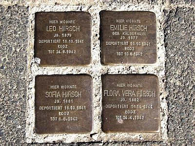 90 m
Stolpersteine (Stumbling Stones)
Stolperstein für Leo Hirsch
90 m
Stolpersteine (Stumbling Stones)
Stolperstein für Emilie Hirsch
90 m
Stolpersteine (Stumbling Stones)
Stolperstein für Sofia Hirsch
90 m
Stolpersteine (Stumbling Stones)
Stolperstein für Flora Vera Hirsch
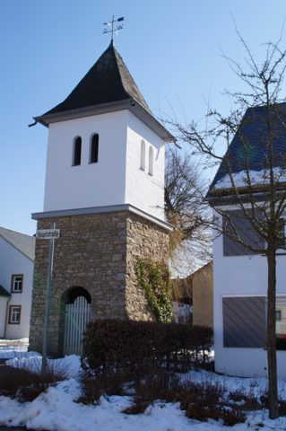 90 m
Bell Towers
Glockenturm
No picture
100 m
Place Names / Local History
Die Mark Thalfang
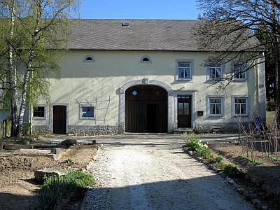 120 m
Farmhouses and Farm Buildings
Quereinhaus
No picture
160 m
Field Names