Wayside Shrines and Stations of the Cross · Renaissance
Zwei Wegekreuze Auf Zalzich

Description
This description is only available in German.
Translate with Google opens this page in Google Translate (external service)
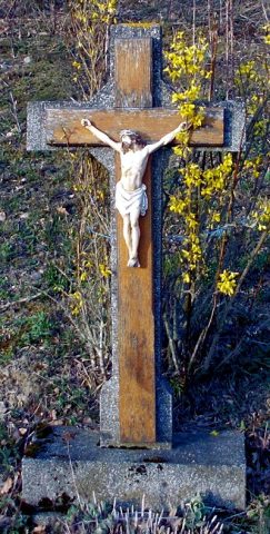
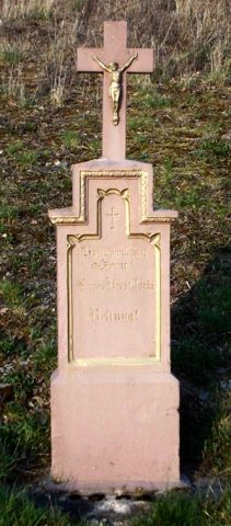
Das älteste der beiden ursprünglichen Kreuze, die in der Zwischenzeit renoviert wurden, stammt vermutlich aus dem Jahr 1663.
Das rechte Kreuz wurde durch einen Verkehrsunfall zerstört und durch Herrn Karl Meyer aus Morscheid 2018 erneuert. [1]
Classification
- Subject area
- Architectural and Art Monuments
- Category
- Religious Buildings
- Object type
- Wayside Shrines and Stations of the Cross
- Date
- 1663
- Period
- Renaissance
- Creator, builder, architect, artist
- Erneuerung: Meyer, Karl aus Morscheid.
Location
- District
- Trier-Saarburg
- Collective municipality
- Ruwer
- Municipality
- Waldrach
- Field name
- Unterst Rauls
- Coordinates
- WGS 84: 49.743105, 6.760014 (Position: exact) WGS 84: 49° 44′ 35.2″ N, 6° 45′ 36.1″ E UTM 32 (ETRS89): E 338620 · N 5512477
Sources
Data sources
On the internet
Picture credits
- Picture 1: © Michael Grün, Trier, 2019.
Last edited: 17 Jun 2019 Object ID: 26087
https://kulturdb.de/en/objekt/26087-waldrach-zwei-wegekreuze-auf-zalzich
Nearby
The nearest objects
 less than 10 m
Wayside Shrines and Stations of the Cross
Wegekreuz im Geißberg
Fortresses and Bunkers
Westwall - Bunker
 90 m
Wayside Shrines and Stations of the Cross
Wegekreuz im Geißberg
Field Names
Sauerwies
Field Names
Auf Zalzickerrech
Vineyard Sites
Ehrenberg
Vineyard Sites
Sonnenberg
Fortresses and Bunkers