Field Names · Gothic
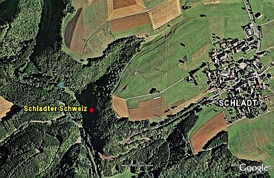
Bei Stroßber Steinkaul


© GeoBasis-DE / LVermGeoRP, dl-de/by-2-0
There is no picture of this object yet. Do you have a photo that you would like to make available to the Kulturdatenbank? Submit a picture
Description
This description is only available in German.
Translate with Google opens this page in Google Translate (external service)
Steinkaul: mittelhochdeutsch steinkûle = Steingrube. [1]
Classification
- Subject area
- History
- Category
- Field Names
- Date
- Circa 1100 bis circa 1500
- Period
- Gothic
Location
- District
- Bernkastel-Wittlich
- Collective municipality
- Wittlich-Land
- Municipality
- Schladt
- Field name
- Bei Stroßber Steinkaul
- Coordinates
- WGS 84: 50.040579, 6.829382 (Position: exact) WGS 84: 50° 02′ 26.1″ N, 6° 49′ 45.8″ E UTM 32 (ETRS89): E 344576 · N 5545400
Sources
Data sources
- [1] Jungandreas, Wolfgang: Historisches Lexikon der Siedlungs- und Flurnamen des Mosellandes. Hrsg. Arbeitsgemeinschaft für Landesgeschichte und Volkskunde des Trierer Raumes; 1962.
On the internet
Last edited: 22 May 2013 Object ID: 27765
https://kulturdb.de/en/objekt/27765-schladt-bei-strossber-steinkaul
Nearby
The nearest objects
Wayside Shrine Houses
Heiligenhäuschen von 1830
Wayside Shrines and Stations of the Cross
Wegekreuz
Wayside Shrines and Stations of the Cross
Wegekreuz
Spur Castles
Burgberg
Spur Castles
Burgberg (2)
Wayside Shrine Houses
Heiligenhäuschen von 1812
Wayside Shrines and Stations of the Cross
Wegekreuz
 1.0 km
Natural Landscapes