Farmhouses and Farm Buildings · Baroque / Rococo
Ehemaliges Maximiner Hof- und Weingut Staadt
Denkmalzone
- Listed monument


© GeoBasis-DE / LVermGeoRP, dl-de/by-2-0
There is no picture of this object yet. Do you have a photo that you would like to make available to the Kulturdatenbank? Submit a picture
Description
This description is only available in German.
Translate with Google opens this page in Google Translate (external service)
Barockes Hofhaus, Mitte des 18. Jahrhunderts, Kelterhaus und Ökonomiergebäude, Arbeiterhäuser, terrassierter Garten mit Brunnen, Wiesenland, ehemaliges Lohheckengelände, Weinberg; Schweizerhaus (um 1850). [1]
Classification
- Subject area
- Architectural and Art Monuments
- Category
- Residential and Farm Buildings
- Object type
- Farmhouses and Farm Buildings
- Date
- Circa 1700 bis circa 1780
- Period
- Baroque / Rococo
Location
- District
- Trier-Saarburg
- Collective municipality
- Saarburg-Kell
- Municipality
- Kastel-Staadt
- Locality / location
- Staadt
- Street
- Staadt 1 und 3
- Field name
- Staader Wies
- Coordinates
- WGS 84: 49.574440, 6.565000 (Position: exact) WGS 84: 49° 34′ 28.0″ N, 6° 33′ 54.0″ E UTM 32 (ETRS89): E 323964 · N 5494165
Sources
Data sources
- [1] Denkmalliste der Generaldirektion Kulturelles Erbe, Rheinland-Pfalz; 2010.
On the internet
Last edited: 25 May 2013 Object ID: 27834
https://kulturdb.de/en/objekt/27834-kastel-staadt-ehemaliges-maximiner-hof-und-weingut-staadt
Nearby
The nearest objects
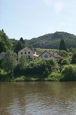 40 m
Place Names / Local History
Ortsgeschichte Staadt
Ferries
Ehemalige Wagenfähre
Vineyard Sites
Wingertsheck
Field Names
Aufm Dörmorgen
Fortresses and Bunkers
Westwall - Schartenstand
Fords
Ehemalige Furt
Fortresses and Bunkers
Westwall - Doppelschartenstand
Fords