Deserted Settlements · Renaissance
Wüstung Reiferscheid


Description
This description is only available in German.
Translate with Google opens this page in Google Translate (external service)
Sie stellt eine völlig in sich geschlossene Kleinlandschaft dar und könnte durchaus als Flur eines gleichnamigen Dorfes aufgefasst werden. [1]
Classification
- Subject area
- Archaeological Monuments
- Category
- Settlements
- Object type
- Deserted Settlements
- Date
- Circa 1500 bis circa 1700
- Period
- Renaissance
Location
- District
- Bernkastel-Wittlich
- Collective municipality
- Wittlich-Land
- Municipality
- Bettenfeld
- Field name
- Auf dem Kirchenberg
- Coordinates
- WGS 84: 50.084273, 6.788837 (Position: exact) WGS 84: 50° 05′ 03.4″ N, 6° 47′ 19.8″ E UTM 32 (ETRS89): E 341816 · N 5550342
Sources
Data sources
- [1] Janssen, W.: Studien zur Wüstungsfrage im fränkischen Altsiedelland zwischen Rhein, Mosel und Eifelnordrand. 2 Bände. Text u. Katalog, 1975.
On the internet
Picture credits
Last edited: 17 Apr 2001 Object ID: 279
https://kulturdb.de/en/objekt/279-bettenfeld-wuestung-reiferscheid
Nearby
The nearest objects
No picture
90 m
Field Names
Auf dem Kirchenberg
No picture
160 m
Field Names
Vor dem Kirchenberg
No picture
330 m
Field Names
Ober dem Stevelsborn
No picture
330 m
Field Names
Kirchenberg
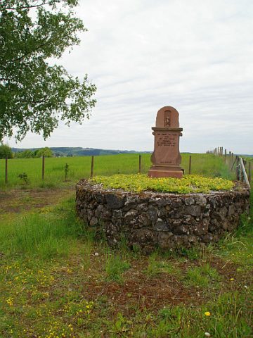 370 m
Wayside Shrines and Stations of the Cross
Bildstock am Weg zur Heidsmühle
No picture
420 m
Field Names
Am Lehningsborn
No picture
500 m
Burial Mounds
Grabhügel
No picture
530 m
Field Names