Wayside Shrines and Stations of the Cross · Undated
Wegekreuz

Classification
- Subject area
- Architectural and Art Monuments
- Category
- Religious Buildings
- Object type
- Wayside Shrines and Stations of the Cross
- Date
- Undatiert
- Period
- Undated
Location
- District
- Bernkastel-Wittlich
- Collective municipality
- Bernkastel-Kues
- Municipality
- Maring-Noviand
- Locality / location
- Siebenborn
- Field name
- Im Macherberg
- Coordinates
- WGS 84: 49.944110, 6.999910 (Position: exact) WGS 84: 49° 56′ 38.8″ N, 6° 59′ 59.7″ E UTM 32 (ETRS89): E 356498 · N 5534334
Sources
Data sources
- Manfred Knapp, Nohfelden, 2013.
On the internet
Picture credits
- Picture 1: © Manfred Knapp, Nohfelden, 2013.
Last edited: 15 Nov 2013 Object ID: 32564
https://kulturdb.de/en/objekt/32564-maring-noviand-wegekreuz
Nearby
The nearest objects
 270 m
Surveying
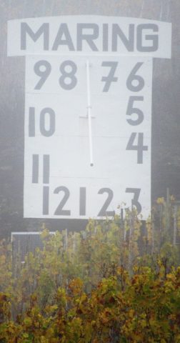
Sonnenuhr Maring
No picture
390 m
Field Names
Auf Mötschertsborn
No picture
420 m
Observation Towers
Aussichtsturm auf dem Kreinskopf
No picture
780 m
Field Names
4 Morgen
No picture
800 m
Field Names
Aufm Grundgraben
No picture
820 m
Field Names
Grundgraben
No picture
880 m
Field Names
In den Vier Morgen
No picture
900 m
Extraction and Processing of Raw Materials