Wayside Shrines and Stations of the Cross · Undated
Wegekreuz


© GeoBasis-DE / LVermGeoRP, dl-de/by-2-0
There is no picture of this object yet. Do you have a photo that you would like to make available to the Kulturdatenbank? Submit a picture
Classification
- Subject area
- Architectural and Art Monuments
- Category
- Religious Buildings
- Object type
- Wayside Shrines and Stations of the Cross
- Date
- Undatiert
- Period
- Undated
Location
- District
- Eifelkreis Bitburg-Prüm
- Collective municipality
- Südeifel
- Municipality
- Heilbach
- Street
- Gegenüber Hauptstraße 4
- Field name
- In der Thommesdell
- Coordinates
- WGS 84: 50.058280, 6.293190 (Position: exact) WGS 84: 50° 03′ 29.8″ N, 6° 17′ 35.5″ E UTM 32 (ETRS89): E 306258 · N 5548621
Sources
Data sources
- [1] GeoPortal des Landes Rheinland-Pfalz. http://www.geoportal.rlp.de/
On the internet
Last edited: 4 Jan 2014 Object ID: 32899
https://kulturdb.de/en/objekt/32899-heilbach-wegekreuz
Nearby
The nearest objects
No picture
80 m
Place Names / Local History
Ortsgeschichte Heilbach
No picture
140 m
Field Names
Thommesdell
 170 m
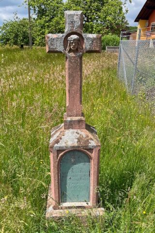
Wayside Shrines and Stations of the Cross
Altarkreuz
No picture
220 m
Field Names
Im Neuenzenpesch
No picture
230 m
Field Names
In der Alzdell
No picture
250 m
Field Names
In der Dell
No picture
270 m
Chapels
Kapelle
No picture
280 m
Wayside Shrines and Stations of the Cross