Viewpoints · Undated
Aussichtspunkt


Classification
- Subject area
- Natural Features
- Category
- Viewpoints
- Date
- Undatiert
- Period
- Undated
Location
- District
- Trier-Saarburg
- Collective municipality
- Ruwer
- Municipality
- Schöndorf
- Field name
- Beim verbrannten Kreuz
- Coordinates
- WGS 84: 49.688237, 6.737036 (Position: exact) WGS 84: 49° 41′ 17.7″ N, 6° 44′ 13.3″ E UTM 32 (ETRS89): E 336781 · N 5506427
Sources
Data sources
- [1] Wanderkarten im Maßstab 1:50.000 und 1:25.000.
On the internet
Picture credits
Last edited: 29 Jun 2020 Object ID: 33154
https://kulturdb.de/en/objekt/33154-schoendorf-aussichtspunkt
Nearby
The nearest objects
No picture
60 m
Field Names
Beim verbrannten Kreuz
No picture
120 m
Field Names
Auf der Steinkaul
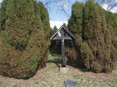 130 m
Wayside Shrines and Stations of the Cross
Das sogenannte Gebrannte Kreuz
No picture
280 m
Vineyard Sites
Hinter den Königsfeldern auf dem Wingertsberg
No picture
320 m
Vineyard Sites
Aufm Wingertsberg
No picture
390 m
Field Names
Zwergstücker
No picture
410 m
Vineyard Sites
Wingertsberg
No picture
440 m
Field Names