Wayside Shrines and Stations of the Cross · Undated
Wegekreuz


Description
This description is only available in German.
Translate with Google opens this page in Google Translate (external service)
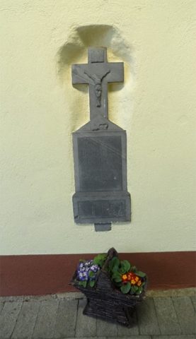
Dieses Kreuz steht gegenüber dem Gasthaus Waldesruh auf Dahnen – Wehrbüsch, an der Straße rechts. Es ist ein altes Grabkreuz, wie mir der Besitzer Herrn Fiedler mitteilte. In der Mitte war einst eine schwarze Schrifttafel aus Marmor, die durch einen Steinschlag in Brüche ging. [1]
Classification
- Subject area
- Architectural and Art Monuments
- Category
- Religious Buildings
- Object type
- Wayside Shrines and Stations of the Cross
- Date
- Undatiert
- Period
- Undated
Location
- District
- Eifelkreis Bitburg-Prüm
- Collective municipality
- Arzfeld
- Municipality
- Dahnen
- Field name
- Rodersseif
- Coordinates
- WGS 84: 50.105836, 6.158729 (Position: exact) WGS 84: 50° 06′ 21.0″ N, 6° 09′ 31.4″ E UTM 32 (ETRS89): E 296836 · N 5554264
Sources
Data sources
- [1] Helmut Bauer, Trier, 2023.
On the internet
Picture credits
Last edited: 7 Dec 2023 Object ID: 33477
https://kulturdb.de/en/objekt/33477-dahnen-wegekreuz
Nearby
The nearest objects
 20 m
Fortresses and Bunkers
Westwall - Bunker ohne Kampfraum
 50 m
Wayside Shrines and Stations of the Cross
Wegekreuz
170 m
Fortresses and Bunkers
Westwall - Bunkertyp nicht eindeutig erkennbar
180 m
Fortresses and Bunkers
Westwall - Schartenstand
220 m
Fortresses and Bunkers
Westwall - Bunker ohne Kampfraum
290 m
Fortresses and Bunkers
Westwall - Bunker ohne Kampfraum
Surveying
Ehemaliger Meilenzeiger
410 m
Fortresses and Bunkers