Field Names · Undated
In der Langfuhr


© GeoBasis-DE / LVermGeoRP, dl-de/by-2-0
There is no picture of this object yet. Do you have a photo that you would like to make available to the Kulturdatenbank? Submit a picture
Description
This description is only available in German.
Translate with Google opens this page in Google Translate (external service)
Der Flurname weist auf die langgestreckte Form eines Flurstückes hin.
Classification
- Subject area
- History
- Category
- Field Names
- Date
- Undatiert
- Period
- Undated
Location
- District
- Trier-Saarburg
- Collective municipality
- Saarburg-Kell
- Municipality
- Waldweiler
- Field name
- In der Langfuhr
- Coordinates
- WGS 84: 49.619237, 6.794367 (Position: exact) WGS 84: 49° 37′ 09.3″ N, 6° 47′ 39.7″ E UTM 32 (ETRS89): E 340690 · N 5498633
Sources
Data sources
- Hessisches Landesamt für geschichtliche Landeskunde. http://www.hlgl.de
On the internet
Last edited: 4 Apr 2014 Object ID: 34300
https://kulturdb.de/en/objekt/34300-waldweiler-in-der-langfuhr
Nearby
The nearest objects
Field Names
Unterm Kirchenweg 2. Gewann
Field Names
Aufm Schellenborn
Field Names
Unterm Kirchenweg 1. Gewann
Field Names
Unterm Kirchenweg 3. Gewann
 410 m
Wayside Shrines and Stations of the Cross
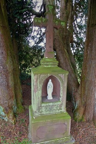
Wegekreuz am nördlichen Dorfrand
Field Names
Im Heidelborn
Field Names
Auf der Kosterei 2. Gewann
Field Names