Railways · Historicism / Art Nouveau
Moseltalbahn - Ehemaliger Haltepunkt


© GeoBasis-DE / LVermGeoRP, dl-de/by-2-0
There is no picture of this object yet. Do you have a photo that you would like to make available to the Kulturdatenbank? Submit a picture
Classification
- Subject area
- Architectural and Art Monuments
- Object type
- Railways
- Date
- 1914
Location
- District
- Bernkastel-Wittlich
- Town
- Bernkastel-Kues
- Locality / location
- Andel
- Street
- Am Ring
- Field name
- Ortslage
- Coordinates
- WGS 84: 49.907093, 7.047298 (Position: exact) WGS 84: 49° 54′ 25.5″ N, 7° 02′ 50.3″ E UTM 32 (ETRS89): E 359791 · N 5530129
Sources
Data sources
- [1] Topographische Karte von 1914.
On the internet
Last edited: 12 Sep 2020 Object ID: 34772
https://kulturdb.de/en/objekt/34772-bernkastel-kues-moseltalbahn-ehemaliger-haltepunkt
Nearby
The nearest objects
No picture
120 m
Field Names
Im Entenloch
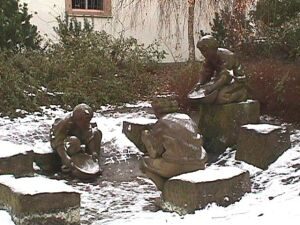 270 m
Works of Art
Goldbrunnen
No picture
290 m
Vineyard Sites
Im Alt Wingert
No picture
390 m
Settlements
Römische Villenanlage mit Bad
No picture
410 m
Farmhouses and Farm Buildings
Wohnhaus
No picture
450 m
Wayside Shrines and Stations of the Cross
Wegekreuz
No picture
470 m
Vineyard Sites
Schloßberg
No picture
490 m
Vineyard Sites