Railways · Historicism / Art Nouveau
Moseltalbahn - Ehemalige Haltestelle Burg

Description
This description is only available in German.
Translate with Google opens this page in Google Translate (external service)
An der ehemaligen Fährverbindung Reil - Burg (Mosel). [1]
Classification
- Subject area
- Architectural and Art Monuments
- Object type
- Railways
- Date
- 1888
Location
- District
- Bernkastel-Wittlich
- Collective municipality
- Traben-Trarbach
- Municipality
- Reil
- Field name
- Unten in der Burgerbach
- Coordinates
- WGS 84: 50.009548, 7.119083 (Position: exact) WGS 84: 50° 00′ 34.4″ N, 7° 07′ 08.7″ E UTM 32 (ETRS89): E 365231 · N 5541387
Sources
Data sources
- [1] Topographische Karte von 1888.
On the internet
Picture credits
- Picture 1: © Helmut Reichelt, Koblenz, 2020. http://www.mec-lahnstein-koblenz.de
Last edited: 11 Sep 2020 Object ID: 34777
https://kulturdb.de/en/objekt/34777-reil-moseltalbahn-ehemalige-haltestelle-burg
Nearby
The nearest objects
 10 m
Wayside Shrines and Stations of the Cross
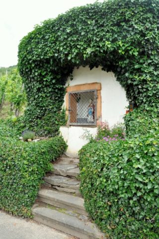
Sankt-Nikolaus-Bildstock
No picture
100 m
Extraction and Processing of Raw Materials
Ehemaliger Steinbruch
No picture
110 m
Ferries
Ehemalige Moselfähre
 140 m
Rocks
Reiler Steinerne Schlange
No picture
200 m
Washing Places
Bleichwiese am Moselufer
No picture
230 m
Field Names
Burgerbacherkehr
No picture
290 m
Field Names
Oben in Breitrech
No picture
360 m
Extraction and Processing of Raw Materials