Fountains and Wells · Neoclassicism
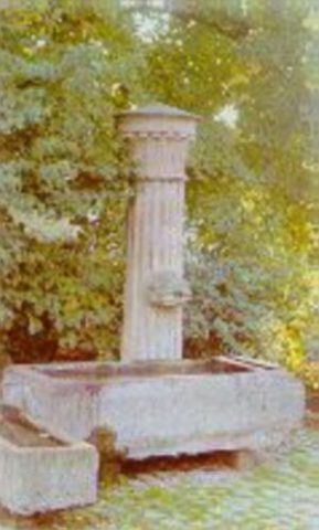
Brunnenstock
- Listed monument

Description
This description is only available in German.
Translate with Google opens this page in Google Translate (external service)
Dorfplatz mit Brunnen, Dorflinde; Brunnenstock aus dem 19. Jahrhundert. [1]
Classification
- Subject area
- Architectural and Art Monuments
- Category
- Fountains and Wells
- Date
- 19. Jahrhundert
- Period
- Neoclassicism
Location
- District
- Trier-Saarburg
- Collective municipality
- Schweich an der römischen Weinstraße
- Municipality
- Klüsserath
- Street
- Ecke Lindenstraße / Hauptstraße
- Field name
- Ortslage
- Coordinates
- WGS 84: 49.845370, 6.860970 (Position: exact) WGS 84: 49° 50′ 43.3″ N, 6° 51′ 39.5″ E UTM 32 (ETRS89): E 346217 · N 5523633
Sources
Data sources
- [1] Seite "Liste der Kulturdenkmäler in Klüsserath". In: Wikipedia, Die freie Enzyklopädie. Bearbeitungsstand: 26. September 2017, 14:18 UTC. URL: https://de.wikipedia.org/w/index.php?title=Liste_der_Kulturdenkm%C3… (Abgerufen: 9. März 2018, 21:27 UTC)
On the internet
Picture credits
- Picture 1: Von Helge Klaus Rieder - Eigenes Werk, CC0, https://commons.wikimedia.org/w/index.php?curid=60024386
Last edited: 9 Mar 2018 Object ID: 34981
https://kulturdb.de/en/objekt/34981-kluesserath-brunnenstock
Nearby
The nearest objects
 less than 10 m
Execution Sites
Gerichtslinde
No picture
10 m
Farmhouses and Farm Buildings
Streckhof
 20 m
Wayside Shrines and Stations of the Cross
Schaftbildstock
No picture
60 m
Castles
Burghaus
No picture
90 m
Settlements
Römische Siedlungsstelle
No picture
110 m
Vineyard Sites
Bruderschaft
No picture
130 m
Field Names
Beim Langenborn
No picture
170 m
Field Names