Settlements · Celtic / Roman Period
Römische Villa
- Listed monument


© GeoBasis-DE / LVermGeoRP, dl-de/by-2-0
There is no picture of this object yet. Do you have a photo that you would like to make available to the Kulturdatenbank? Submit a picture
Classification
- Subject area
- Archaeological Monuments
- Category
- Settlements
- Object type
- Settlements
- Date
- Circa 500 vor Chr. bis circa 500 nach Chr.
- Period
- Celtic / Roman Period
Location
- District
- Bernkastel-Wittlich
- Collective municipality
- Traben-Trarbach
- Municipality
- Irmenach
- Locality / location
- Beuren
- Field name
- Unter Struth
- Coordinates
- WGS 84: 49.911409, 7.212795 (Position: exact) WGS 84: 49° 54′ 41.1″ N, 7° 12′ 46.1″ E UTM 32 (ETRS89): E 371685 · N 5530312
Sources
Data sources
- [1] Digitale TK25. Landesamt für Vermessung und Geobasisinformation Rheinland-Pfalz. 2001 (ISBN 3-89637-345-5)
On the internet
Last edited: 29 Oct 2001 Object ID: 3673
https://kulturdb.de/en/objekt/3673-irmenach-roemische-villa
Nearby
The nearest objects
No picture
420 m
Burial Mounds
Römergrab
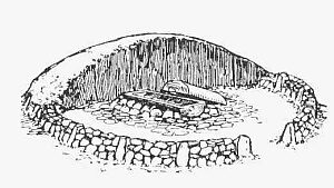 700 m
Burial Mounds
Hügelgrab
840 m
Burial Mounds
Hügelgrab
No picture
970 m
Field Names
In Weiroth
No picture
1.1 km
Town Houses and Commercial Buildings
Kleine Villa
No picture
1.2 km
Field Names
In Weiroth
No picture
1.3 km
Field Names
Anspann
No picture
1.7 km
Field Names