Field Names · Undated
Oben im Burgberg


© GeoBasis-DE / LVermGeoRP, dl-de/by-2-0
There is no picture of this object yet. Do you have a photo that you would like to make available to the Kulturdatenbank? Submit a picture
Description
This description is only available in German.
Translate with Google opens this page in Google Translate (external service)
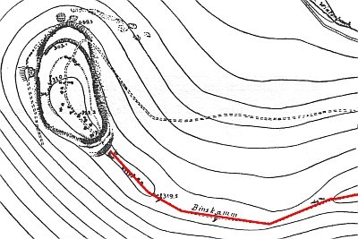
Flur 7 - Sie bildet ein kleines Stückchen Land über dem auslaufenden Sommerbachsgraben am Fuße des Burgberges. Es ist ein sonniges Plätzchen, begehrt zum Bau von Wochenendhäuschen. [1]
Classification
- Subject area
- History
- Category
- Field Names
- Date
- Undatiert
- Period
- Undated
Location
- District
- Trier-Saarburg
- Collective municipality
- Trier-Land
- Municipality
- Kordel
- Field name
- Oben im Burgberg
- Coordinates
- WGS 84: 49.851120, 6.651460 (Position: exact) WGS 84: 49° 51′ 04.0″ N, 6° 39′ 05.3″ E UTM 32 (ETRS89): E 331176 · N 5524723
Sources
Data sources
- [1] Anton Obser: Kordel. Geschichte der Kylltalgemeinde. Hrsg. Ortsgemeinde Kordel, 1982.
On the internet
Last edited: 3 Jun 2015 Object ID: 38996
https://kulturdb.de/en/objekt/38996-kordel-oben-im-burgberg
Nearby
The nearest objects
Field Names
Oben in der Sammerbach
 190 m
Street Names
Binskamm
 230 m
Charcoal Kilns
Ehemaliger Meilerplatz
240 m
Charcoal Kilns
Ehemaliger Meilerplatz
300 m
Charcoal Kilns
Ehemaliger Meilerplatz
300 m
Charcoal Kilns
Ehemaliger Meilerplatz
320 m
Charcoal Kilns
Ehemaliger Meilerplatz
 360 m
Field Names