Extraction and Processing of Raw Materials · 20th Century
Ehemalige Sandgrube


Description
This description is only available in German.
Translate with Google opens this page in Google Translate (external service)
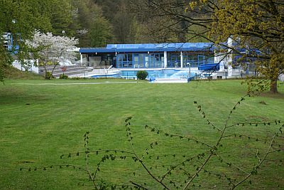
Im Bereich des heutigen Freibades. [1]
Classification
- Subject area
- Architectural and Art Monuments
- Category
- Economy, Trade and Transport
- Object type
- Extraction and Processing of Raw Materials
- Date
- Vor 1960
- Period
- 20th Century
Location
- District
- Trier-Saarburg
- Collective municipality
- Trier-Land
- Municipality
- Kordel
- Field name
- Stadtfelder
- Coordinates
- WGS 84: 49.846554, 6.644987 (Position: exact) WGS 84: 49° 50′ 47.6″ N, 6° 38′ 42.0″ E UTM 32 (ETRS89): E 330695 · N 5524230
Sources
Data sources
- [1] Ludwig Lieser, Kordel, 2015.
On the internet
de.wikipedia.org/wiki/Kordeler_Sandstein
Picture credits
Last edited: 8 Jul 2020 Object ID: 39384
https://kulturdb.de/en/objekt/39384-kordel-ehemalige-sandgrube
Nearby
The nearest objects
 less than 10 m
Settlements
Römische Fundstelle
 80 m
Field Names
Ober der Fahnenwies
 80 m
Field Names
Unter Kaderichswies
 120 m
Field Names
Stadtfelder
 140 m
Parks, Gardens and Cemeteries
Ehemaliger Tierfriedhof
 180 m
Field Names
Auf dem Brett
180 m
Field Names
In der Kaderich
 200 m
Field Names