Field Names · Gothic
Schei


© GeoBasis-DE / LVermGeoRP, dl-de/by-2-0
There is no picture of this object yet. Do you have a photo that you would like to make available to the Kulturdatenbank? Submit a picture
Description
This description is only available in German.
Translate with Google opens this page in Google Translate (external service)
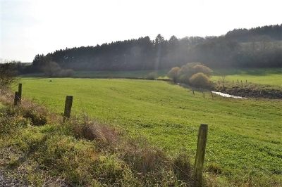
Die Schei (wie das Tal genannt wird - Schei stammt von dem Wort Scheuern) wird allgemein von allen benachbarten Orten seit alten Zeiten stiefkindlic betrachtet, da sie immer Grenzland war, davon ca. 600 Jahre Grenze zwischen Luxemburg und Trier. Entsprechend meiner Einschätzung dürften im Mittelalter große Teile der Nachbardörfer von diesem Tal, das heute nur Grünfläche bietet, gelebt haben. [1]
Classification
- Subject area
- History
- Category
- Field Names
- Date
- Circa 1100 bis circa 1500
- Period
- Gothic
Location
- District
- Eifelkreis Bitburg-Prüm
- Collective municipality
- Speicher
- Municipality
- Spangdahlem
- Field name
- Schei
- Coordinates
- WGS 84: 50.000210, 6.673070 (Position: exact) WGS 84: 50° 00′ 00.8″ N, 6° 40′ 23.1″ E UTM 32 (ETRS89): E 333244 · N 5541249
Sources
Data sources
- [1] Günter Leers, Spangdahlem, 2017. https://www.youtube.com/@keltentrevererundromer-xk3zp
On the internet
Last edited: 27 Mar 2017 Object ID: 42867
https://kulturdb.de/en/objekt/42867-spangdahlem-schei
Nearby
The nearest objects
Extraction and Processing of Raw Materials
Ehemalige Eisenerzwäsche - Abtransport
Field Names
Bornwiese
Settlements
Römische Villa von Pickließem
Deserted Settlements
Ehemaliger Hof Aldendorf
Extraction and Processing of Raw Materials
Ehemalige Eisenerzwäsche - Steinzerkleinerung
 480 m
Extraction and Processing of Raw Materials
Ehemalige Eisenerzwäsche
 530 m
Fords
Mittelaterliche Furt durch den Spanger Bach
Extraction and Processing of Raw Materials