Extraction and Processing of Raw Materials · Gothic
Ehemaliger Eisenerz-Tagebau am Klosterberg


© GeoBasis-DE / LVermGeoRP, dl-de/by-2-0
There is no picture of this object yet. Do you have a photo that you would like to make available to the Kulturdatenbank? Submit a picture
Description
This description is only available in German.
Translate with Google opens this page in Google Translate (external service)
Der ausgedehnteste Tagebau im Umfeld von Himmerod liegt auf dem Sporn des Klosterbergs zwischen Himmerod und dem Altenhof. Auf einer Fläche von ca. 200 x 159 m ist hier der Obere Buntsandstein entlang der Grenze zum Mittleren Buntsandstein ca. 5-7 m tief ausgebrochen. [1]
Classification
- Subject area
- Architectural and Art Monuments
- Category
- Economy, Trade and Transport
- Object type
- Extraction and Processing of Raw Materials
- Date
- 12. Jahrhundert
- Period
- Gothic
Location
- District
- Bernkastel-Wittlich
- Collective municipality
- Wittlich-Land
- Municipality
- Landscheid
- Locality / location
- Burg/Salm
- Field name
- Im Klosterberg
- Coordinates
- WGS 84: 50.022580, 6.756090 (Position: exact) WGS 84: 50° 01′ 21.3″ N, 6° 45′ 21.9″ E UTM 32 (ETRS89): E 339268 · N 5543554
Sources
Data sources
- [1] Kuhnen, Hans-Peter: "Claustrum" und Eisenerz. Zur Montanarchäologie im Umfeld des Zisterzienserklosters Himmerod, VG Manderscheid, Lkr. Bernkastel-Wittlich. In: Kurtrierisches Jahrbuch, 49 Jahrgang 2009. http://www.mgh-bibliothek.de/dokumente/b/b042331.pdf
- [2] Topographische Karte 1:25000 von 1887. http://kartenforum.slub-dresden.de/vkviewer?%3Fwelcomepage=off&z=10…
On the internet
Last edited: 28 Mar 2017 Object ID: 42885
https://kulturdb.de/en/objekt/42885-landscheid-ehemaliger-eisenerz-tagebau-am-klosterberg
Nearby
The nearest objects
Field Names
Im Klosterberg
Extraction and Processing of Raw Materials
Ehemaliger Eisenerz-Tagebau am Klosterberg
Extraction and Processing of Raw Materials
Ehemaliger Eisenerz-Tagebau am Klosterberg
Wayside Shrines and Stations of the Cross
Wegekreuz nördlich von Altenhof
Surveying
Trigonometrisches Signal am Klosterberg
 340 m
War Cemeteries
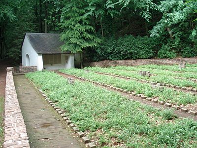
Ehrenfriedhof Himmerod
350 m
Chapels
Ehrenfriedhof Himmerod - Gedächtniskapelle
Hospitals