Field Names · Undated
Hinter Roth im Brühl


© GeoBasis-DE / LVermGeoRP, dl-de/by-2-0
There is no picture of this object yet. Do you have a photo that you would like to make available to the Kulturdatenbank? Submit a picture
Description
This description is only available in German.
Translate with Google opens this page in Google Translate (external service)
Flurnamen: Rod – Röder
ROD (Roth, Rott, Rath, Röth, Ray, Roy; Diminutiv Rödchen, Rädchen, Röttgen, Rötchen; Plural Röder, Rotter, Rother, Ruder) – Bedeutung: Stelle einer Rodung zum Zwecke der Flurerweiterung oder der Siedlung. [1]
Das Wort Brühl kommt aus dem Lateinisch-Althochdeutschen von bro[g]ilus, auch broil, bruil, mittelhochdeutsch brüel und bedeutet grundherrliche Wiese, eingehegter Wildpark, eingehegtes Gehölz. [...] Das Wort Brühl existiert heute noch als Orts- und Flurname und ist in West- und Süddeutschland verbreitet, heute aber meist gleichbedeutend mit fette, sumpfige Wiese. [2]
Classification
- Subject area
- History
- Category
- Field Names
- Date
- Undatiert
- Period
- Undated
Location
- District
- Eifelkreis Bitburg-Prüm
- Collective municipality
- Bitburger Land
- Municipality
- Ingendorf
- Field name
- Hinter Roth im Brühl
- Coordinates
- WGS 84: 49.936246, 6.439515 (Position: exact) WGS 84: 49° 56′ 10.5″ N, 6° 26′ 22.3″ E UTM 32 (ETRS89): E 316265 · N 5534685
Sources
Data sources
- [1] Dittmaier, Heinrich: Rheinische Flurnamen. Ludwig Röhrscheid Verlag, Bonn, 1963.
- [2] http://genwiki.genealogy.net/Br%C3%BChl
On the internet
Last edited: 28 Jan 2020 Object ID: 43233
https://kulturdb.de/en/objekt/43233-ingendorf-hinter-roth-im-bruehl
Nearby
The nearest objects
Field Names
Hinter Roth in der Heck
Field Names
Hinter Roth
Field Names
Hinter Roth im Gründchen
Field Names
Scheuernheld
Field Names
In der Breitwies
Field Names
Hinter Roth am Berg
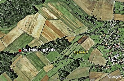 310 m
Deserted Settlements
Dorfwüstung Rode
 330 m
Wild Service Trees