Extraction and Processing of Raw Materials · Neoclassicism
Ehemaliger Steinbruch


© GeoBasis-DE / LVermGeoRP, dl-de/by-2-0
There is no picture of this object yet. Do you have a photo that you would like to make available to the Kulturdatenbank? Submit a picture
Classification
- Subject area
- Architectural and Art Monuments
- Category
- Economy, Trade and Transport
- Object type
- Extraction and Processing of Raw Materials
- Date
- 1850
- Period
- Neoclassicism
Location
- District
- Eifelkreis Bitburg-Prüm
- Collective municipality
- Bitburger Land
- Municipality
- Schleid
- Locality / location
- Pintenhof
- Field name
- In Reutersfeld
- Coordinates
- WGS 84: 50.075900, 6.490500 (Position: exact) WGS 84: 50° 04′ 33.2″ N, 6° 29′ 25.8″ E UTM 32 (ETRS89): E 320445 · N 5550086
Sources
Data sources
- [1] Preußische Kartenaufnahme 1:25000 Uraufnahme (1843-1878), Blatt.: 3396, Waxweiler von 1850, © GeoBasis-DE / LVermGeoRP 2016, dl-de/by-2-0, www.lvermgeo.rlp.de
On the internet
Last edited: 11 Oct 2017 Object ID: 44634
https://kulturdb.de/en/objekt/44634-schleid-ehemaliger-steinbruch
Nearby
The nearest objects
No picture
310 m
Fords
Ehemalige Furt durch die Nims
No picture
590 m
Wayside Shrines and Stations of the Cross
Wegekreuz
No picture
590 m
Field Names
In der Sauerwies
No picture
650 m
Wayside Shrines and Stations of the Cross
Wegekreuz
No picture
700 m
Field Names
Auf Krummenacker
 700 m
Wayside Shrines and Stations of the Cross
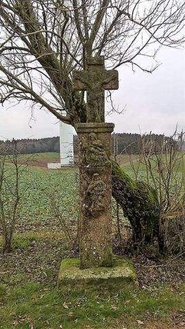
Schaftkreuz von 1760
No picture
780 m
Field Names
Aufm Werth
No picture
920 m
Field Names