Field Names · Undated
Grufweg


© GeoBasis-DE / LVermGeoRP, dl-de/by-2-0
There is no picture of this object yet. Do you have a photo that you would like to make available to the Kulturdatenbank? Submit a picture
Description
This description is only available in German.
Translate with Google opens this page in Google Translate (external service)
Gruf – Grube, Vertiefung [1]
Classification
- Subject area
- History
- Category
- Field Names
- Date
- Undatiert
- Period
- Undated
Location
- District
- Trier-Saarburg
- Collective municipality
- Saarburg-Kell
- Town
- Saarburg
- Field name
- Grufweg
- Coordinates
- WGS 84: 49.617707, 6.565047 (Position: exact) WGS 84: 49° 37′ 03.7″ N, 6° 33′ 54.2″ E UTM 32 (ETRS89): E 324123 · N 5498975
Sources
Data sources
- [1] Die Flurnamen des Dorfes. http://www.weiler-saar.de/html/body_flurnamen.htm
On the internet
Last edited: 1 Nov 2017 Object ID: 44972
https://kulturdb.de/en/objekt/44972-saarburg-grufweg
Nearby
The nearest objects
Fortresses and Bunkers
Westwall - Maschinengewehr-Schartenstand
Field Names
Querlen auf die Grufels
Fortresses and Bunkers
Westwall - Maschinengewehr-Schartenstand
Fortresses and Bunkers
Westwall - Schartenturm
 170 m
Wayside Shrines and Stations of the Cross
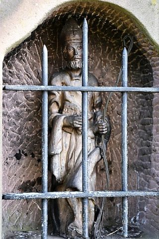
Nikolausstatue beim Sportboothafen
Fortresses and Bunkers
Westwall - Maschinengewehr-Schartenstand
Fortresses and Bunkers
Westwall - Schartenturm
Fortresses and Bunkers