Natural Landscapes · Undated
Gebranntes Bruch
Naturschutzgebiet
- Listed monument


© GeoBasis-DE / LVermGeoRP, dl-de/by-2-0
There is no picture of this object yet. Do you have a photo that you would like to make available to the Kulturdatenbank? Submit a picture
Description
This description is only available in German.
Translate with Google opens this page in Google Translate (external service)
Moorwälder auf 25 ha Fläche, das findet man nur im Gebrannten Bruch. In diesem Moor ist der größte zusammenhängen Moorwald im Hunsrück erhalten. [1]
Classification
- Subject area
- Natural Features
- Category
- Natural Landscapes
- Date
- Undatiert
- Period
- Undated
Location
- District
- Bernkastel-Wittlich
- Collective municipality
- Einheitsgemeinde Morbach
- Municipality
- Morbach
- Field name
- Forst Morbach
- Coordinates
- WGS 84: 49.816340, 7.180750 (Position: exact) WGS 84: 49° 48′ 58.8″ N, 7° 10′ 50.7″ E UTM 32 (ETRS89): E 369127 · N 5519798
Sources
Data sources
- [1] NSG-Album Gebranntes Bruch.pdf - LUWG
- http://213.139.159.59/binarywriterservlet?imgUid=36714bc7-a15a-1419…
On the internet
Last edited: 7 Dec 2017 Object ID: 46012
https://kulturdb.de/en/objekt/46012-morbach-gebranntes-bruch
Nearby
The nearest objects
Bogs and Mires
Rehbruch
 560 m
Natural Landscapes
Bruch Gilleswiese
 1.1 km
Natural Landscapes
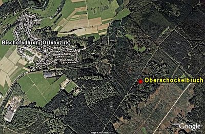
Oberschockelbruch
1.3 km
Natural Landscapes
Palmbruch
Forest Names
Friedwald
Wayside Shrines and Stations of the Cross
Wegekreuz
Wayside Shrines and Stations of the Cross
Wegekreuz
Field Names