Settlements · Celtic / Roman Period
Römische Siedlungsreste auf dem Huhnenkopf

Description
This description is only available in German.
Translate with Google opens this page in Google Translate (external service)
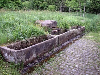
Bei Carl befindet sich eine größere Anlage auf dem Huhnenkopf, (heute: Hunnenkopf 440,1 Meter über Normal-Null - Red.) 2,1 Kilometer nordwestlich der Kirche: lange Steinwälle als Reste von Umfassungsmauern und auf der Höhe eine alte Zisterne (heute: Alter Brunnen - Anm. d. Red.) Die Art der anscheinen recht umfangreichen Siedlung ist noch nicht geklärt.
Siedlungsreste ferner am nördlichen Fuß des Huhnenkopfes.
Classification
- Subject area
- Archaeological Monuments
- Category
- Settlements
- Object type
- Settlements
- Date
- Circa 500 vor Chr. bis circa 500 nach Chr.
- Period
- Celtic / Roman Period
Location
- District
- Bernkastel-Wittlich
- Collective municipality
- Wittlich-Land
- Municipality
- Karl
- Field name
- Kunohochwald
- Coordinates
- WGS 84: 50.046905, 6.774765 (Position: exact) WGS 84: 50° 02′ 48.9″ N, 6° 46′ 29.2″ E UTM 32 (ETRS89): E 340686 · N 5546218
Sources
Data sources
- Ernst Wackenroder: Die Kunstdenkmäler der Rheinprovinz; Band Kreis Wittlich; Düsseldorf 1934.
On the internet
Picture credits
- Picture 1: © Lothar Monshausen, Fotostream http://www.flickr.com/photos/lomo56/tags/meteorite/
Last edited: 10 May 2002 Object ID: 4743
https://kulturdb.de/en/objekt/4743-karl-roemische-siedlungsreste-auf-dem-huhnenkopf
Nearby
The nearest objects
Find Sites
Römerzeitliche Funde
Burial Mounds
Grabhügel
 970 m
Springs
Limmerborn
Burial Mounds
Grabhügel
Vineyard Sites
Unterm Wingertsberg
 1.1 km
Oaks
Hohenmarken-Eiche
Field Names
Krichelhöhe
 1.5 km
Settlements