Pilgrimage Routes · Undated
Pilgerstein Nr. 10


© GeoBasis-DE / LVermGeoRP, dl-de/by-2-0
There is no picture of this object yet. Do you have a photo that you would like to make available to the Kulturdatenbank? Submit a picture
Classification
- Subject area
- Architectural and Art Monuments
- Category
- Markers and Monuments
- Object type
- Pilgrimage Routes
- Date
- Undatiert
- Period
- Undated
Location
- District
- Bernkastel-Wittlich
- Collective municipality
- Traben-Trarbach
- Municipality
- Hontheim
- Locality / location
- Wispelt
- Field name
- Helche Flur
- Coordinates
- WGS 84: 50.045630, 6.990380 (Position: presumed) WGS 84: 50° 02′ 44.3″ N, 6° 59′ 25.4″ E UTM 32 (ETRS89): E 356118 · N 5545639
Sources
On the internet
Last edited: 14 May 2018 Object ID: 47666
https://kulturdb.de/en/objekt/47666-hontheim-pilgerstein-nr-10
Nearby
The nearest objects
No picture
220 m
Extraction and Processing of Raw Materials
Ehemaliger Steinbruch
No picture
230 m
Burial Mounds
Grabhügel
No picture
270 m
Field Names
Appiegen
No picture
460 m
Settlements
Reste der Römerstraße bei Wispelt
No picture
540 m
Find Sites
Römische Fundstelle
No picture
590 m
Field Names
Wispelt
No picture
630 m
Field Names
Ein Viertel Busch
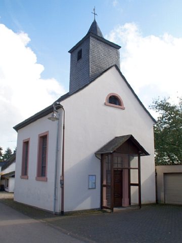 700 m
Catholic Churches