Wayside Shrines and Stations of the Cross · Historicism / Art Nouveau
Ehemaliges Echtes Caseler Bildchen


© GeoBasis-DE / LVermGeoRP, dl-de/by-2-0
There is no picture of this object yet. Do you have a photo that you would like to make available to the Kulturdatenbank? Submit a picture
Description
This description is only available in German.
Translate with Google opens this page in Google Translate (external service)
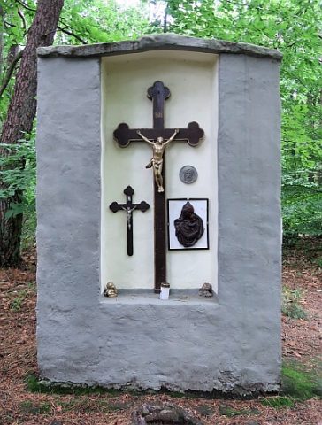
An dem echten Caseler Bildchen soll ein ungesühnter Gattenmord begangen worden sein. Das "Bildchen" ist ein Mittelding zwischen Kapelle und Votivstein und der Muttergottes geweiht. Von seinem Standpunkte aus sieht man durch eine Schneise ins Ruwertal, bei gutem Wetter wohl auch bis Casel. [1]
Classification
- Subject area
- Architectural and Art Monuments
- Category
- Religious Buildings
- Object type
- Wayside Shrines and Stations of the Cross
- Date
- Circa 1850 bis 1920
Location
- District
- City of Trier
- Collective municipality
- Verbandsfreie Gemeinde Trier
- Town
- Trier
- Locality / location
- Ehrang-Quint
- Field name
- Jungenwald
- Coordinates
- WGS 84: 49.794501, 6.671557 (Position: exact) WGS 84: 49° 47′ 40.2″ N, 6° 40′ 17.6″ E UTM 32 (ETRS89): E 332425 · N 5518384
Sources
Data sources
- [1] Eifelvereinsblatt, 4. Jahrgang 1903, Nr.8 https://www.dilibri.de/rlb/periodical/pageview/193800?query=bildchen
- [2] Lage: Manfred Fritsch und Jürgen Schankweiler, Trier-Ehrang und Alfred Lieser, Kordel, 2019.
On the internet
eifelverein-trier.de/index.php/bildergalerie/geschichte/358-1964-errichtung-des-eifelkreuzes
Last edited: 11 Dec 2019 Object ID: 48740
https://kulturdb.de/en/objekt/48740-trier-ehemaliges-echtes-caseler-bildchen
Nearby
The nearest objects
 30 m
Wayside Shrines and Stations of the Cross
Holzkreuz auf der Bausch
 40 m
Charcoal Kilns
Ehemaliger Meilerplatz
100 m
Charcoal Kilns
Ehemaliger Meilerplatz
120 m
Charcoal Kilns
Ehemaliger Meilerplatz
150 m
Charcoal Kilns
Ehemaliger Meilerplatz
160 m
Charcoal Kilns
Ehemaliger Meilerplatz
170 m
Charcoal Kilns
Ehemaliger Meilerplatz
180 m
Charcoal Kilns